


这个项目的开发工作其实在于理解全部的YOLO代码,其实还是很苦逼的,人家一个大团队的代码我来看就比较累
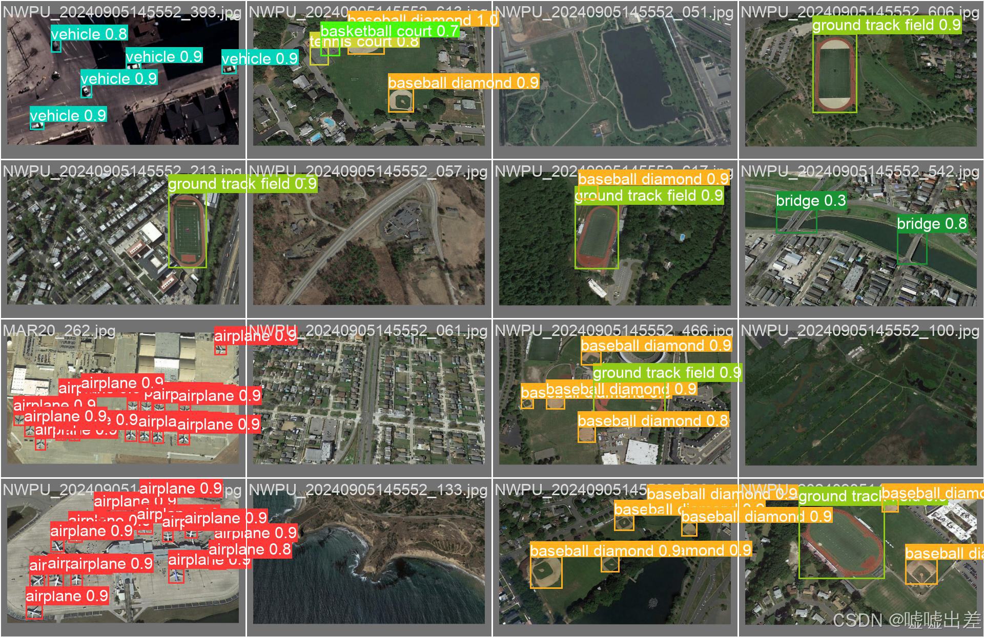
结果图如下
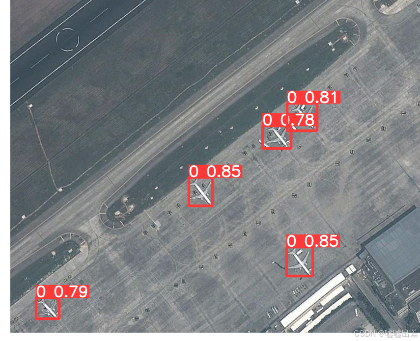
就是加了点别人的开源的军用飞机图像作为数据集进行训练,也就是加了些飞机样本
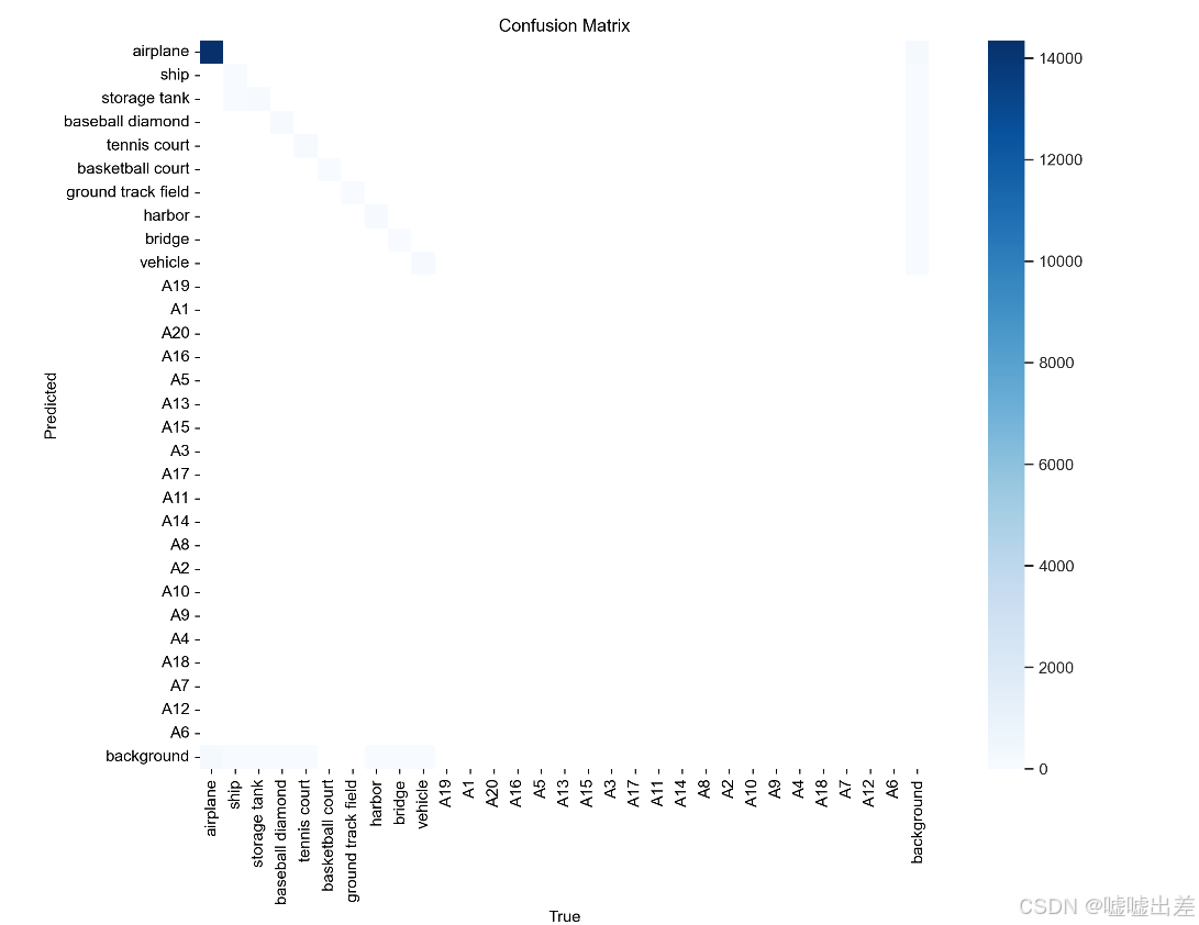
结果就是样本不均衡而已
然后训练是废了
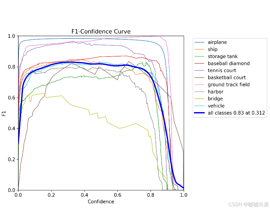
准确率
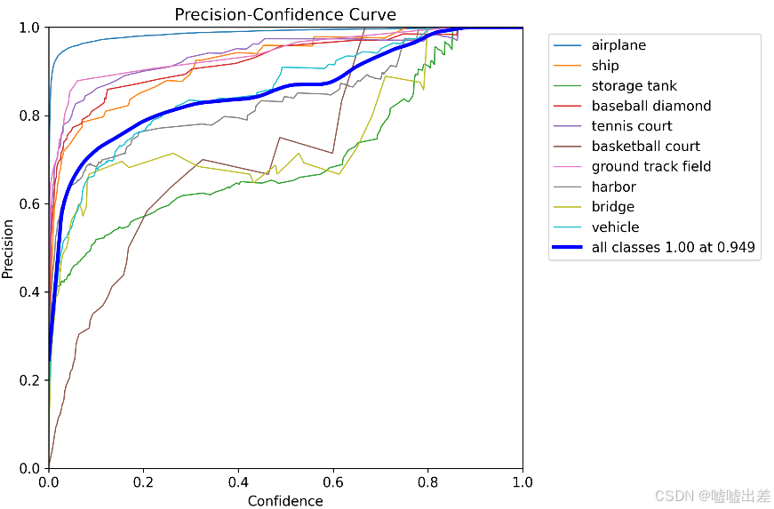
很明显不太行
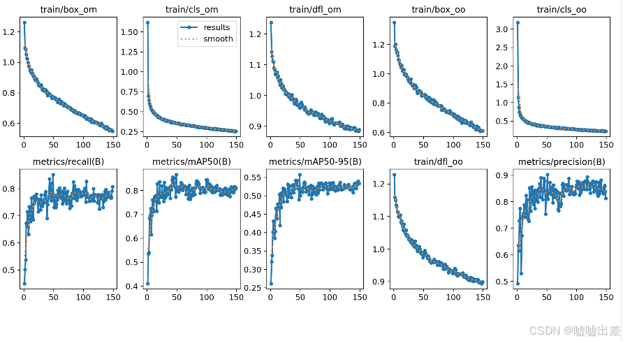
全是飞机什么的
然后
部署这个api的代码
import os

import numpy as np
import torch
from PIL.Image import Image
from PIL.ImageWin import Window
from rasterio import MemoryFile

from ultralytics import YOLOv10
from fastapi import FastAPI, File, UploadFile
from pydantic import BaseModel
import numpy as np
import torch
import rasterio
from ultralytics import YOLOv10
import requests
import json
from typing import List, Dict
app = FastAPI()
class DetectionModelPlaneService:
    def __init__(self):
        self.names = {
            0: "airplane",
            1: "ship",
            2: "storage tank",
            3: "baseball diamond",
            4: "tennis court",
            5: "basketball court",
            6: "ground track field",
            7: "harbor",
            8: "bridge",
            9: "vehicle"
        }
        self.model_config = 'project/v10/yolov10m.yaml'
        weights_path = r'E:\System_settings\Project\yolov10-main\project\model_plane\model\runs\train\plane4\weights\best.pt'
        data_config = r"E:\System_settings\Project\yolov10-main\project\model_plane\dataset\plane.yaml"
        self.model = YOLOv10(data_config).load(weights_path)


    def model_plane_predict(self,img,conf=0.5):
        # 配置文件和权重路径
        device = torch.device('cuda:0' if torch.cuda.is_available() else 'cpu')
        results = self.model.predict(
            source=img,
            conf=conf,
            data=self.data_config,
            imgsz = 512,
            device=device
        )
        results = results[0]
        # results.show()
        return results.tojson()

    def convert_to_geo_coordinates(self, prediction, transform, offset):
        return {
            "bbox": {
                "left": transform[2] + offset[1] * transform[0],
                "top": transform[5] + offset[0] * transform[4],
                "right": transform[2] + (offset[1] + 512) * transform[0],
                "bottom": transform[5] + (offset[0] + 512) * transform[4]
            },
            "prediction": prediction
        }

    def GetPostandStorage(self,tif_file: UploadFile, cache_path: str,  tile_size: int = 512,
                          stride: int = 512):
        try:
            # Ensure cache path exists
            if not os.path.exists(cache_path):
                os.makedirs(cache_path)

            # Open the TIFF file
            with rasterio.open(tif_file.file) as src:
                profile = src.profile
                image = src.read()
                transform = src.transform

                if image.shape[0] == 4:
                    image = image[:3]  # Discard alpha band if present
                elif image.shape[0] != 3:
                    return {"id": tif_file.filename, "error_code": "Unsupported number of bands"}

                # Variables to store information about slices
                slice_info = []

                # Calculate the number of slices required
                width = src.width
                height = src.height

                # Handle image edges
                num_x_slices = (width - tile_size) // stride + 1
                num_y_slices = (height - tile_size) // stride + 1

                # Loop through each slice
                for x in range(num_x_slices):
                    for y in range(num_y_slices):
                        # Calculate slice bounds
                        col_off = x * stride
                        row_off = y * stride
                        window = Window(col_off, row_off, tile_size, tile_size)

                        # Check if the slice is within image bounds
                        if col_off + tile_size > width:
                            window = Window(width - tile_size, row_off, tile_size, tile_size)
                        if row_off + tile_size > height:
                            window = Window(col_off, height - tile_size, tile_size, tile_size)

                        transform_slice = transform * transform.scale(
                            width / window.width,
                            height / window.height
                        )
                        # Read and process the slice
                        slice_image = src.read(window=window)
                        # Convert slice image to 8-bit per channel (JPEG format)
                        slice_image = np.moveaxis(slice_image, 0, -1)  # Move channels to last dimension
                        slice_image = np.clip(slice_image, 0, 255).astype(np.uint8)  # Clip values to 0-255 range
                        # Convert to PIL Image and save as JPEG
                        slice_pil_image = Image.fromarray(slice_image)
                        slice_filename = f"{tif_file.filename}_slice_{x}_{y}.jpg"
                        slice_path = os.path.join(cache_path, slice_filename)
                        slice_pil_image.save(slice_path)
                        # Record slice information including geo-transform
                        slice_info.append({
                            "filename": slice_path,
                            "bounds": {
                                "left": window.col_off,
                                "top": window.row_off,
                                "right": window.col_off + window.width,
                                "bottom": window.row_off + window.height
                            },
                            "transform": {
                                "scale_x": transform_slice[0],
                                "scale_y": transform_slice[4],
                                "translation_x": transform_slice[2],
                                "translation_y": transform_slice[5],
                                "rotation_x": transform_slice[1],
                                "rotation_y": transform_slice[3]
                            }
                        })
            for slice in slice_info:
                # Load the image and run detection
                img_path = os.path.join(cache_path, slice['filename'])
                img = Image.open(img_path)
                detections = self.model_plane_predict(img, conf=0.5)
                # Process detections to geographic coordinates
                slice_detections = self.process_detections(detections, slice['transform'], (tile_size, tile_size))
                slice['detections'] = slice_detections
                # Save updated slice info
            info_file = os.path.join(cache_path, "slice_info.json")
            with open(info_file, 'w') as f:
                json.dump(slice_info, f, indent=4)
            return {"id": tif_file.filename, "status": "success", "slice_info": slice_info}

        except Exception as e:
            return {"id": tif_file.filename, "error_code": str(e)}


model_service = DetectionModelPlaneService()


@app.post("/process_tif")
async def process_tif(tif_file: UploadFile = File(...), cache_path: str = "cache/"):
    result = model_service.GetPostandStorage(tif_file, cache_path)
    return result


if __name__ == "__main__":
    import uvicorn
    uvicorn.run(app, host="0.0.0.0", port=8000)


 473
473

 被折叠的 条评论
为什么被折叠?
被折叠的 条评论
为什么被折叠?
 到【灌水乐园】发言


