


 本篇博客介绍了如何在Cesium中使用Geoserver和GeoWebCache显示S-57海图。首先下载geoserver 2.21.0和GeoWebCache 1.21.0,然后详细说明了如何修改Geoserver的GeoWebCache配置,包括拷贝、解压文件,编辑geowebcache-core-context.xml和geowebcache-servlet.xml文件,最后进行切片数据配置并重启服务。下一篇文章将讨论跨域问题的解决方案。
文章目录
显示s-57海图 (三)
上一章我们完成了完成切片。本章完成切片导入geoserver。
1. 下载geoserver 2.21.0
https://jaist.dl.sourceforge.net/project/geoserver/GeoServer/2.21.0/geoserver-2.21.0-bin.zip
2. 下载GeoWebCache 1.21.0
https://sourceforge.net/projects/geowebcache/files/geowebcache/1.21.0/
3. 修改Geoserver的GeoWebCache配置
3.1 拷贝文件
拷贝geowebcache/WEB-INF/lib/gwc-arcgiscache-1.21.0.jar至D:\geoserver-2.21.0-bin\webapps\geoserver\WEB-INF\lib目录下;
3.2 解压、拷贝文件
    解压D:\geoserver-2.21.0-bin\webapps\geoserver\WEB-INF\lib\gs-gwc-2.21.0.jar至D:\gs-gwc-2.21.0文件夹;

    拷贝geowebcache/WEB-INF/geowebcache-arcgiscache-context.xml至D:\gs-gwc-2.21.0文件夹
3.3 编辑geowebcache-core-context.xml文件
打开D:\gs-gwc-2.21.0文件夹下的geowebcache-core-context.xml文件,添加以下代码:
<bean id="gwcArcGIGridsetConfigutation" class="org.geowebcache.arcgis.layer.ArcGISCacheGridsetConfiguration"/>
修改后的完整geowebcache-core-context.xml文件如下
<?xml version="1.0" encoding="UTF-8"?>
<!DOCTYPE beans PUBLIC "-//SPRING//DTD BEAN//EN" "http://www.springframework.org/dtd/spring-beans.dtd">
<beans>
<description>
Bean configuration file for the gwc-core module
</description>
<bean id="geoWebCacheExtensions" class="org.geowebcache.GeoWebCacheExtensions"/>
<bean id="geoWebCacheEnvironment" class="org.geowebcache.GeoWebCacheEnvironment" depends-on="geoWebCacheExtensions"/>
<bean id="gwcAppCtx" class="org.geowebcache.util.ApplicationContextProvider" />
<bean id="gwcXmlConfigResourceProvider" class="org.geoserver.gwc.config.GeoserverXMLResourceProvider">
<constructor-arg value="geowebcache.xml" />
<constructor-arg ref="resourceStore" />
</bean>
<!-- The location of a static configuration file for GeoWebCache.
By default this lives in WEB-INF/classes/geowebcache.xml -->
<bean id="gwcXmlConfig" class="org.geowebcache.config.XMLConfiguration">
<constructor-arg ref="gwcAppCtx" />
<constructor-arg ref="gwcXmlConfigResourceProvider" />
<property name="template" value="/geowebcache_empty.xml">
<description>Create an empty geoebcache.xml in data_dir/gwc as template</description>
</property>
</bean>
<!-- If you like to automatically configure GWC from a WMS Getcapabilities document,
change the values below. The last constructor-arg lets you specify parameters
that are appended to every WMS request to the backed, for example:
"format_options=regionate_by:auto&bgcolor=0x112233"
You also need to uncomment gwcWMSConfig in the gwcTLDispatcher bean!
-->
<!--bean id="gwcWMSConfig" class="org.geowebcache.config.wms.GetCapabilitiesConfiguration">
<constructor-arg ref="gwcGridSetBroker">
</constructor-arg>
<constructor-arg value="http://demo.mapserver.org/cgi-bin/mapserv?map=/osgeo/mapserver/msautotest/world/world.map&SERVICE=WMS&VERSION=1.1.1&REQUEST=GetCapabilities">
<description>The URL to the WMS GetCapabilities document, notice & , port is normally 8080</description>
</constructor-arg>
<constructor-arg value="image/png">
<description>The formats to support for all layers read for the above document</description>
</constructor-arg>
<constructor-arg value="3x3">
<description>Metatiling factors, 3x3 is usually a good compromise for vector data</description>
</constructor-arg>
<constructor-arg value="map=/osgeo/mapserver/msautotest/world/world.map">
<description>
Vendor parameters, these are appended to every request sent to the backend.
If you use MapServer you probably want to set this to "map=name". Leave the value attribute empty if you don't need
to add any vendor specific parameter.
</description>
</constructor-arg>
<constructor-arg value="false">
<description>Whether to allow cached=false to specificed for certain requests</description>
</constructor-arg>
</bean-->
<!-- For each configuration bean above, add them below to activate -->
<bean id="gwcTLDispatcher" class="org.geowebcache.layer.TileLayerDispatcher" depends-on="gwcCatalogConfiguration,geoWebCacheExtensions">
<description>
TileLayerDispatcher serves up TileLayers from the available Configurations in the application context
</description>
<constructor-arg ref="gwcGridSetBroker"/>
</bean>
<bean id="gwcBlobStoreAggregator" class="org.geowebcache.storage.BlobStoreAggregator">
<description>
BlobStoreAggregator serves up BlobStoreInfos from the available Configurations in the application context
</description>
</bean>
<bean id="gwcDefaultStorageFinder" class="org.geowebcache.storage.DefaultStorageFinder">
<constructor-arg ref="gwcAppCtx" />
</bean>
<bean id="gwcBlobStore" class="org.geowebcache.storage.CompositeBlobStore" destroy-method="destroy">
<constructor-arg ref="gwcTLDispatcher"/>
<constructor-arg ref="gwcDefaultStorageFinder" />
<constructor-arg ref="gwcBlobStoreAggregator"/>
<constructor-arg ref="gwcXmlConfig"/>
</bean>
<!-- Static definition of where to put the blobstore.
Note that the directory MUST EXIST when GWC is started. -->
<!-- bean id="gwcBlobStore" class="org.geowebcache.storage.blobstore.file.FileBlobStore" destroy-method="destroy">
<constructor-arg value="/tmp/gwc_blobstore" />
</bean -->
<bean id="gwcStorageBroker" class="org.geowebcache.storage.DefaultStorageBroker" destroy-method="destroy">
<constructor-arg ref="gwcConfigBlobStore" />
<constructor-arg>
<bean class="org.geowebcache.storage.TransientCache">
<constructor-arg index="0" value="100"/>
<constructor-arg index="1" value="1024"/>
<constructor-arg index="2" value="2000"/>
</bean>
</constructor-arg>
</bean>
<bean id="gwcGridSetBroker" class="org.geowebcache.grid.GridSetBroker">
<constructor-arg>
<list>
<bean id="defaultGridsets" class="org.geowebcache.config.DefaultGridsets">
<!-- Should we used EPSG:900913 instead of EPSG:3857 ? -->
<constructor-arg type="boolean" value="TRUE" />
<!--
Should the default grids be named EPSG:4326 and EPSG:900913 (TRUE),
or (FALSE) use the new names similar to what WMTS suggests,
GlobalCRS84Geometric and GoogleMapsCompatible ?
If you say FALSE here, you have to manually
rename the directories and entries in the H2 database.
-->
<constructor-arg type="boolean" value="TRUE" />
</bean>
</list>
</constructor-arg>
</bean>
<bean id="gwcRuntimeStats" class="org.geowebcache.stats.RuntimeStats" destroy-method="destroy">
<!-- The poll interval, the number of seconds until counters are aggregated -->
<constructor-arg type="int" value="3" />
<!-- The intervals (in seconds) for which aggregates are reported.
Each interval must be a multiple of the poll interval above and
listed in ascending order. For example, for a maximum interval
of 60 seconds and 3 second poll interval from above, the amount
of memory consumed is (60 / 3) * 8 = 160 bytes
-->
<constructor-arg>
<list>
<value>3</value>
<value>15</value>
<value>60</value>
</list>
</constructor-arg>
<!-- Descriptive texts for each of the intervals above -->
<constructor-arg>
<list>
<value>3 seconds</value>
<value>15 seconds</value>
<value>60 seconds</value>
</list>
</constructor-arg>
</bean>
<!-- controller for handling all incoming requests -->
<bean id="geowebcacheDispatcher" class="org.geowebcache.GeoWebCacheDispatcher" destroy-method="destroy">
<constructor-arg ref="gwcTLDispatcher"/>
<constructor-arg ref="gwcGridSetBroker"/>
<constructor-arg ref="gwcStorageBroker"/>
<constructor-arg ref="gwcBlobStoreAggregator"/>
<constructor-arg ref="gwcXmlConfig"/>
<constructor-arg ref="gwcRuntimeStats"/>
<property name="defaultStorageFinder" ref="gwcDefaultStorageFinder"/>
<property name="securityDispatcher" ref="gwcSecurityDispatcher"/>
<property name="servletPrefix" value="gwc"/>
</bean>
<!-- Thread pool for seeding -->
<bean id="gwcSeederThreadPoolExec"
class="org.geoserver.gwc.seed.SeederThreadLocalTransferExecutor">
<constructor-arg value="16"/><!-- Size of core pool -->
<constructor-arg value="32"/><!-- Maximum size of pool -->
</bean>
<!-- Breeder (the one that seeds) -->
<bean id="gwcTileBreeder" class="org.geowebcache.seed.TileBreeder">
<property name="tileLayerDispatcher" ref="gwcTLDispatcher"/>
<property name="threadPoolExecutor" ref="gwcSeederThreadPoolExec"/>
<property name="storageBroker" ref="gwcStorageBroker"/>
</bean>
<bean id="gwcProxyDispatcher"
class="org.geowebcache.proxy.ProxyDispatcher"/>
<!-- Lock providers -->
<bean id="noLock" class="org.geowebcache.locks.NoOpLockProvider"/>
<bean id="gwcURLMangler" class="org.geoserver.gwc.ResponseUtilsURLMangler" />
<bean id="gwcSecurityDispatcher" class="org.geowebcache.filter.security.SecurityDispatcher" />
<bean id="memoryLock" class="org.geowebcache.locks.MemoryLockProvider"/>
<bean id="nioLock" class="org.geowebcache.locks.NIOLockProvider">
<constructor-arg ref="gwcDefaultStorageFinder"/>
</bean>
<bean id="globalLock" class="org.geoserver.gwc.GeoServerLockProvider">
<property name="delegate" ref="lockProvider"/>
</bean>
<!-- The tool performing the automatic migration between metastore and fs hashes -->
<bean id="metastoreRemover" class="org.geowebcache.storage.MetastoreRemover">
<constructor-arg ref="gwcDefaultStorageFinder"/>
</bean>
<bean id="cacheConfiguration" class="org.geowebcache.storage.blobstore.memory.CacheConfiguration">
<property name="hardMemoryLimit" value="64"/> <!-- 64 Mb -->
<property name="policy" value="EXPIRE_AFTER_ACCESS"/> <!-- 64 Mb -->
</bean>
<bean id="guavaCacheProvider" class="org.geowebcache.storage.blobstore.memory.guava.GuavaCacheProvider">
<constructor-arg ref="cacheConfiguration"/>
</bean>
<bean id="gwcMemoryBlobStore" class="org.geowebcache.storage.blobstore.memory.MemoryBlobStore" destroy-method="destroy">
<property name="store" ref="gwcBlobStore" />
<property name="cacheProvider" ref="guavaCacheProvider" />
</bean>
<bean id="gwcNullBlobStore" class="org.geowebcache.storage.blobstore.memory.NullBlobStore" destroy-method="destroy"/>
<bean id="gwcConfigBlobStore" class="org.geoserver.gwc.ConfigurableBlobStore" destroy-method="destroy">
<constructor-arg ref="gwcBlobStore" />
<constructor-arg ref="gwcMemoryBlobStore" />
<constructor-arg ref="gwcNullBlobStore" />
</bean>
<bean id="gwcArcGIGridsetConfigutation" class="org.geowebcache.arcgis.layer.ArcGISCacheGridsetConfiguration"/>
</beans>
3.4 编辑geowebcache-servlet.xml文件
打开D:\gs-gwc-2.21.0文件夹下的geowebcache-servlet.xml文件,添加以下代码:
<import resource="geowebcache-arcgiscache-context.xml"/>
修改后的完整geowebcache-servlet.xml文件如下
<?xml version="1.0" encoding="UTF-8"?>
<beans xmlns="http://www.springframework.org/schema/beans"
       xmlns:xsi="http://www.w3.org/2001/XMLSchema-instance"
       xmlns:context="http://www.springframework.org/schema/context"
       xmlns:mvc="http://www.springframework.org/schema/mvc"
       xsi:schemaLocation="http://www.springframework.org/schema/beans http://www.springframework.org/schema/beans/spring-beans.xsd
    http://www.springframework.org/schema/context http://www.springframework.org/schema/context/spring-context-4.0.xsd
    http://www.springframework.org/schema/mvc http://www.springframework.org/schema/mvc/spring-mvc-4.0.xsd">

  <description>
   Bean configuration file for the gwc-web module
  </description>
  <import resource="geowebcache-arcgiscache-context.xml"/>
  <import resource="geowebcache-core-context.xml"/>
  <import resource="geowebcache-georss-context.xml"/>
  <import resource="geowebcache-gmaps-context.xml"/>
  <import resource="geowebcache-kmlservice-context.xml"/>
  <import resource="geowebcache-rest-context.xml"/>
  <import resource="geowebcache-tmsservice-context.xml"/>
  <import resource="geowebcache-virtualearth-context.xml"/>
  <import resource="geowebcache-wmsservice-context.xml"/>
  <import resource="geowebcache-wmtsservice-context.xml"/>

  <import resource="geowebcache-diskquota-context.xml"/>

  <!--
    This mappings are different from the standalone gwc ones in that they prepend the ##/gwc prefix to the context so it
    ends up being, for example, /geoserver/gwc/*
  -->
  <bean class="org.springframework.beans.factory.config.PropertyPlaceholderConfigurer">
    <property name="ignoreUnresolvablePlaceholders" value="true" />
    <property name="location">
      <value>classpath:application.properties</value>
    </property>
  </bean>

  <context:component-scan base-package="org.geoserver.gwc.dispatch"/>

</beans>
3.5 文件夹重新打包成jar,并且覆盖源文件
将D:\gs-gwc-2.21.0文件夹打成jar包,覆盖D:\geoserver-2.21.0-bin\webapps\geoserver\WEB-INF\lib\gs-gwc-2.21.0.jar。
jar cvf gs-gwc-2.21.0.jar -C gs-gwc-2.21.0 .
至此完成修改。
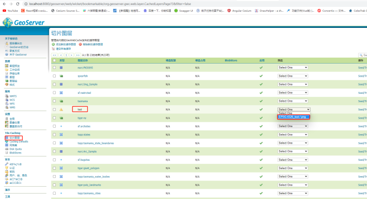
4.切片数据配置
打开D:\geoserver-2.21.0-bin\data_dir\gwc\geowebcache.xml文件,layers节点下添加arcgisLayer节点。
<arcgisLayer>
  <name>test</name>
  <tilingScheme>D:\arcgis-cut-buffer\mycut\layer\conf.xml</tilingScheme>
  <tileCachePath>D:\arcgis-cut-buffer\mycut\layer\_alllayers</tileCachePath>
  <hexZoom>false</hexZoom>
</arcgisLayer>
修改后的完整geowebcache.xml文件
<?xml version="1.0" encoding="utf-8"?>
<gwcConfiguration xmlns:xsi="http://www.w3.org/2001/XMLSchema-instance"
  xmlns="http://geowebcache.org/schema/1.8.0"
  xsi:schemaLocation="http://geowebcache.org/schema/1.8.0 http://geowebcache.org/schema/1.8.0/geowebcache.xsd">
  <version>1.8.0</version>
  <backendTimeout>120</backendTimeout>
  <!--
  <serviceInformation>
    <title>GeoWebCache</title>
    <description>GeoWebCache is an advanced tile cache for WMS servers. It supports a large variety of protocols and
      formats, including WMS-C, WMTS, KML, Google Maps and Virtual Earth.</description>
    <keywords>
      <string>WFS</string>
      <string>WMS</string>
      <string>WMTS</string>
      <string>GEOWEBCACHE</string>
    </keywords>
    <serviceProvider>
      <providerName>John Smith inc.</providerName>
      <providerSite>http://www.example.com/</providerSite>
      <serviceContact>
        <individualName>John Smith</individualName>
        <positionName>Geospatial Expert</positionName>
        <addressType>Work</addressType>
        <addressStreet>1 Bumpy St.</addressStreet>
        <addressCity>Hobart</addressCity>
        <addressAdministrativeArea>TAS</addressAdministrativeArea>
        <addressPostalCode>7005</addressPostalCode>
        <addressCountry>Australia</addressCountry>
        <phoneNumber>+61 3 0000 0000</phoneNumber>
        <faxNumber>+61 3 0000 0001</faxNumber>
        <addressEmail>john.smith@example.com</addressEmail>
      </serviceContact>
    </serviceProvider>
    <fees>NONE</fees>
    <accessConstraints>NONE</accessConstraints>
  </serviceInformation>
  -->
  <gridSets>
    <!-- Grid Set Example, by default EPSG:900913 and EPSG:4326 are defined -->
    <!--
    <gridSet>
      <name>EPSG:2163</name>
      <srs>
        <number>2163</number>
      </srs>
      <extent>
        <coords>
          <double>-2495667.977678598</double>
          <double>-2223677.196231552</double>
          <double>3291070.6104286816</double>
          <double>959189.3312465074</double>
        </coords>
      </extent>
      <scaleDenominators>
        <double>25000000</double>
        <double>1000000</double>
        <double>100000</double>
        <double>25000</double>
      </scaleDenominators>
      <tileHeight>200</tileHeight>
      <tileWidth>200</tileWidth>
    </gridSet>
    -->
  </gridSets>

  <layers>
    <arcgisLayer>
      <name>test</name>
      <tilingScheme>D:\arcgis-cut-buffer\mycut\layer\conf.xml</tilingScheme>
      <tileCachePath>D:\arcgis-cut-buffer\mycut\layer\_alllayers</tileCachePath>
      <hexZoom>false</hexZoom>
    </arcgisLayer>
    <!--
    <wmsLayer>
      <name>topp:states</name>
      <mimeFormats>
        <string>image/gif</string>
        <string>image/jpeg</string>
        <string>image/png</string>
        <string>image/png8</string>
      </mimeFormats>
      <gridSubsets>
        <gridSubset>
          <gridSetName>EPSG:2163</gridSetName>
        </gridSubset>
      </gridSubsets>
      <parameterFilters>
        <stringParameterFilter>
          <key>STYLES</key>
          <defaultValue>population</defaultValue>
          <values>
            <string>population</string>
            <string>polygon</string>
            <string>pophatch</string>
          </values>
        </stringParameterFilter>
      </parameterFilters>
      <wmsUrl>
        <string>http://demo.opengeo.org/geoserver/topp/wms</string>
      </wmsUrl>
    </wmsLayer>

    <wmsLayer>
      <name>raster test layer</name>
      <mimeFormats>
        <string>image/gif</string>
        <string>image/jpeg</string>
        <string>image/png</string>
        <string>image/png8</string>
      </mimeFormats>
      <wmsUrl>
        <string>http://demo.opengeo.org/geoserver/wms</string>
      </wmsUrl>
      <wmsLayers>nurc:Img_Sample</wmsLayers>
    </wmsLayer>

    <wmsLayer>
      <name>img states</name>
      <metaInformation>
        <title>Nicer title for Image States</title>
        <description>This is a description. Fascinating.</description>
      </metaInformation>
      <mimeFormats>
        <string>image/gif</string>
        <string>image/jpeg</string>
        <string>image/png</string>
        <string>image/png8</string>
      </mimeFormats>
      <gridSubsets>
        <gridSubset>
          <gridSetName>EPSG:4326</gridSetName>
          <extent>
            <coords>
              <double>-129.6</double>
              <double>3.45</double>
              <double>-62.1</double>
              <double>70.9</double>
            </coords>
          </extent>
        </gridSubset>
      </gridSubsets>
      <expireCacheList>
        <expirationRule minZoom="0" expiration="60" />
      </expireCacheList>
      <expireClientsList>
        <expirationRule minZoom="0" expiration="500" />
      </expireClientsList>
      <wmsUrl>
        <string>http://demo.opengeo.org/geoserver/wms</string>
      </wmsUrl>
      <wmsLayers>nurc:Img_Sample,topp:states</wmsLayers>
      <transparent>false</transparent>
      <bgColor>0x0066FF</bgColor>
    </wmsLayer>
    -->
  </layers>

</gwcConfiguration>
5.重启
重新启动geoserver。
下一篇讲解如何解决跨域问题。


 3078
3078

 被折叠的 条评论
为什么被折叠?
被折叠的 条评论
为什么被折叠?
 到【灌水乐园】发言


