


一个有用的geotools上传sld样式与shp文件以生成缩略图的方法
前言
发布一些图层的时候觉得图层的缩略图上传太麻烦,又想偷懒上传Shp数据怎么办
其实我觉得解决一点点问题就可以了,只需要SLD文件和SHP文件上传上去,用geotools渲染出缩略图即可。
但是bbox我虽然用了一个自适应的方法来,但是还是有点bug。
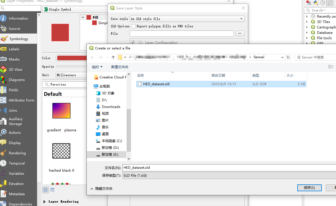
由于QGIS我用的SLD文件导出是1.1.0版本,不兼容我这个版本的geotools,所以,写了一个方法来读取1.1.0版本的SLD文件,来兼容到1.0.0版本,方法是createStyleFromSld
一、geotools缩略图工具类方法
下面的
import java.awt.*;
import java.awt.image.BufferedImage;
import java.io.File;
import java.io.FileInputStream;
import java.io.IOException;
import java.nio.charset.Charset;
import java.util.HashMap;
import java.util.Map;
import javax.imageio.ImageIO;
import javax.xml.parsers.DocumentBuilder;
import javax.xml.parsers.DocumentBuilderFactory;
import javax.xml.parsers.ParserConfigurationException;
import javax.xml.xpath.XPath;
import javax.xml.xpath.XPathExpressionException;
import javax.xml.xpath.XPathFactory;
import org.geotools.data.shapefile.ShapefileDataStore;
import org.geotools.data.simple.SimpleFeatureSource;
import org.geotools.geometry.jts.ReferencedEnvelope;
import org.geotools.map.FeatureLayer;
import org.geotools.map.Layer;
import org.geotools.map.MapContent;
import org.geotools.referencing.crs.DefaultGeographicCRS;
import org.geotools.renderer.lite.StreamingRenderer;
import org.geotools.styling.*;
import org.geotools.xsd.Configuration;
import org.opengis.referencing.crs.CoordinateReferenceSystem;
import org.w3c.dom.Document;
import org.xml.sax.InputSource;
import org.xml.sax.SAXException;

public class Shape2Image {
    private static MapContent map = new MapContent();
    public Style createStyleFromSld(String uri)
            throws XPathExpressionException, IOException, ParserConfigurationException, SAXException {
        File sldFile = new File(uri);
        DocumentBuilderFactory dbf = DocumentBuilderFactory.newInstance();
        DocumentBuilder db = dbf.newDocumentBuilder();
        Document xmlDocument = db.parse(new InputSource(new FileInputStream(sldFile)));
        XPath xPath = XPathFactory.newInstance().newXPath();
        String version = xPath.compile("/StyledLayerDescriptor/@version").evaluate(xmlDocument);
        Configuration sldConf;
        if (version != null && version.startsWith("1.1")) {
            sldConf = new org.geotools.sld.v1_1.SLDConfiguration();
        } else {
            sldConf = new org.geotools.sld.SLDConfiguration();
        }
        StyledLayerDescriptor sld = (StyledLayerDescriptor) new org.geotools.xsd.DOMParser(sldConf, xmlDocument)
                .parse();
        NamedLayer l = (NamedLayer) sld.getStyledLayers()[0];
        Style style = l.getStyles()[0];
        return style;
    }

    public void addShapeLayer(String shpPath, String sldPath){
        try{
            File file = new File(shpPath);
            ShapefileDataStore shpDataStore = null;
            shpDataStore = new ShapefileDataStore(file.toURL());
            //设置编码
            Charset charset = Charset.forName("GB18030");
            shpDataStore.setCharset(charset);
            String typeName = shpDataStore.getTypeNames()[0];
            SimpleFeatureSource featureSource = null;
            featureSource = shpDataStore.getFeatureSource (typeName);
            //SLD的方式
            File sldFile = new File(sldPath);
            //适配1.0.0版本的Sld文件
            Style style = createStyleFromSld(sldPath);
            //StyleFactory styleFactory = CommonFactoryFinder.getStyleFactory();
            //SLDParser stylereader = new SLDParser(styleFactory, sldFile.toURI().toURL());
            //Style[] stylearray = stylereader.readXML();
            //Style style = stylearray[0];
            //默认的方式
            //Style style = SLD.createSimpleStyle(featureSource.getSchema());
            //SLD.setPolyColour(style, Color.RED );
            Layer layer = new FeatureLayer(featureSource, style);

            map.addLayer(layer);

        }

        catch(Exception e){
            e.printStackTrace();

        }

    }
    /**
     * 根据四至、长、宽获取地图内容,并生成图片
     * @param paras
     * @param imgPath
     */
    public void getMapContent(Map paras, String imgPath){
        try{
            double[] bbox = (double[]) paras.get("bbox");
            double x1 = bbox[0], y1 = bbox[1],
                    x2 = bbox[2], y2 = bbox[3];
            int width = (int) paras.get("width"),
                    height=(int) paras.get("height");

            // 设置输出范围
            CoordinateReferenceSystem crs = DefaultGeographicCRS.WGS84;
            ReferencedEnvelope mapArea = new ReferencedEnvelope(x1, x2, y1, y2, crs);
            // 初始化渲染器
            StreamingRenderer sr = new StreamingRenderer();
            sr.setMapContent(map);
            // 初始化输出图像
            BufferedImage bi = new BufferedImage(width, height,
                    BufferedImage.TYPE_INT_ARGB);
            Graphics g = bi.getGraphics();
            ((Graphics2D) g).setRenderingHint(RenderingHints.KEY_ANTIALIASING,
                    RenderingHints.VALUE_ANTIALIAS_ON);
            ((Graphics2D) g).setRenderingHint(RenderingHints.KEY_TEXT_ANTIALIASING,
                    RenderingHints.VALUE_TEXT_ANTIALIAS_ON);
            Rectangle rect = new Rectangle(0, 0, width, height);
            // 绘制地图
            sr.paint((Graphics2D) g, rect, mapArea);
            //将BufferedImage变量写入文件中。
            ImageIO.write(bi,"png",new File(imgPath));
        }
        catch(Exception e){
            e.printStackTrace();
        }
    }
    /**
     * 计算指定 SHP 文件的 BBOX
     *
     * @param shpPath SHP 文件路径
     * @return 计算得到的 BBOX,格式为 double 数组,包含 minX、minY、maxX、maxY
     */
    public static double[] calculateBounds(String shpPath) {
        try {
            File file = new File(shpPath);
            ShapefileDataStore shpDataStore = new ShapefileDataStore(file.toURI().toURL());
            shpDataStore.setCharset(Charset.forName("GBK"));
            SimpleFeatureSource featureSource = shpDataStore.getFeatureSource();
            ReferencedEnvelope bounds = featureSource.getBounds();
            CoordinateReferenceSystem crs = bounds.getCoordinateReferenceSystem();
            double[] bbox = new double[]{bounds.getMinX(), bounds.getMinY(), bounds.getMaxX(), bounds.getMaxY()};
            return bbox;
        } catch (Exception e) {
            e.printStackTrace();
            return null;
        }
    }
    /**
     * 工具类测试方法
     * @param args
     */
    public static void main(String[] args){
        long start = System.currentTimeMillis();
        Shape2Image shp2img = new Shape2Image();
        String shpPath = "E:\\fanwei\\HED_dataset.shp";
        String sldPath = "E:\\fanwei\\HED_dataset.sld";
        String imgPath = "E:\\fanwei\\HED_dataset.png";
        Map paras = new HashMap();
        //自动计算shp矢量的bbox
        double[] bbox = calculateBounds(shpPath);
        //厦门市的bbox
//        double[] bbox = new double[]{117.8833, 24.3833, 118.4333, 24.9};
        paras.put("bbox", bbox);
        paras.put("width", 768);
        paras.put("height", 506);

        shp2img.addShapeLayer(shpPath, sldPath);
        shp2img.getMapContent(paras, imgPath);
        System.out.println("图片生成完成,共耗时"+(System.currentTimeMillis() - start)+"ms");
    }
}
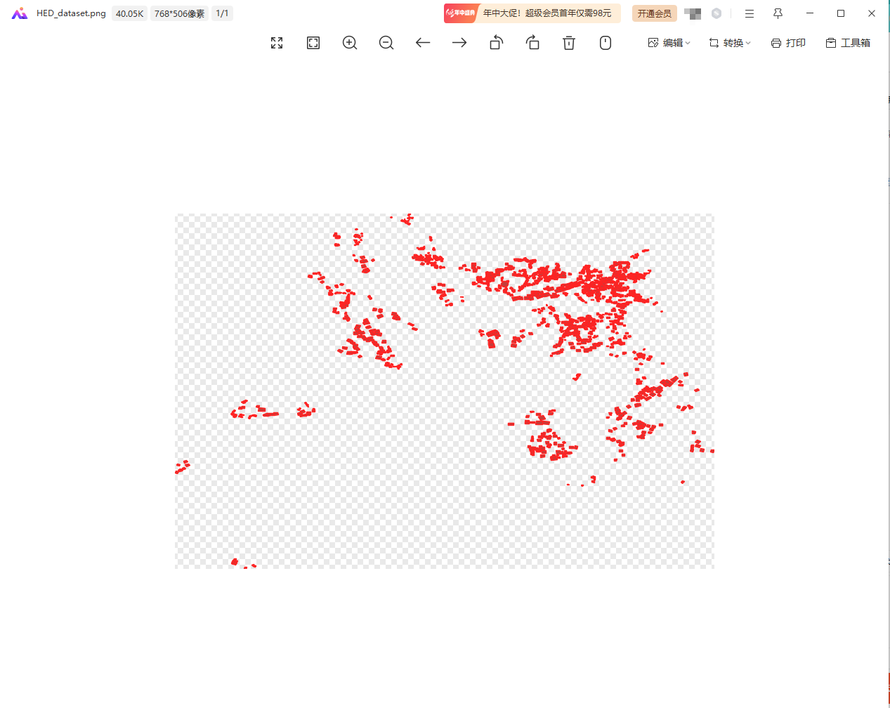
二、结果展示
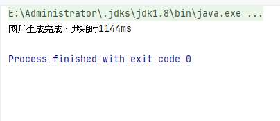
我人很话不多的,直接看结果
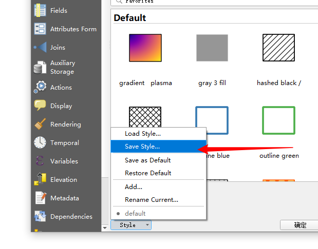
QGIS的样式规则为1.1.0,但是代码里的有方法处理
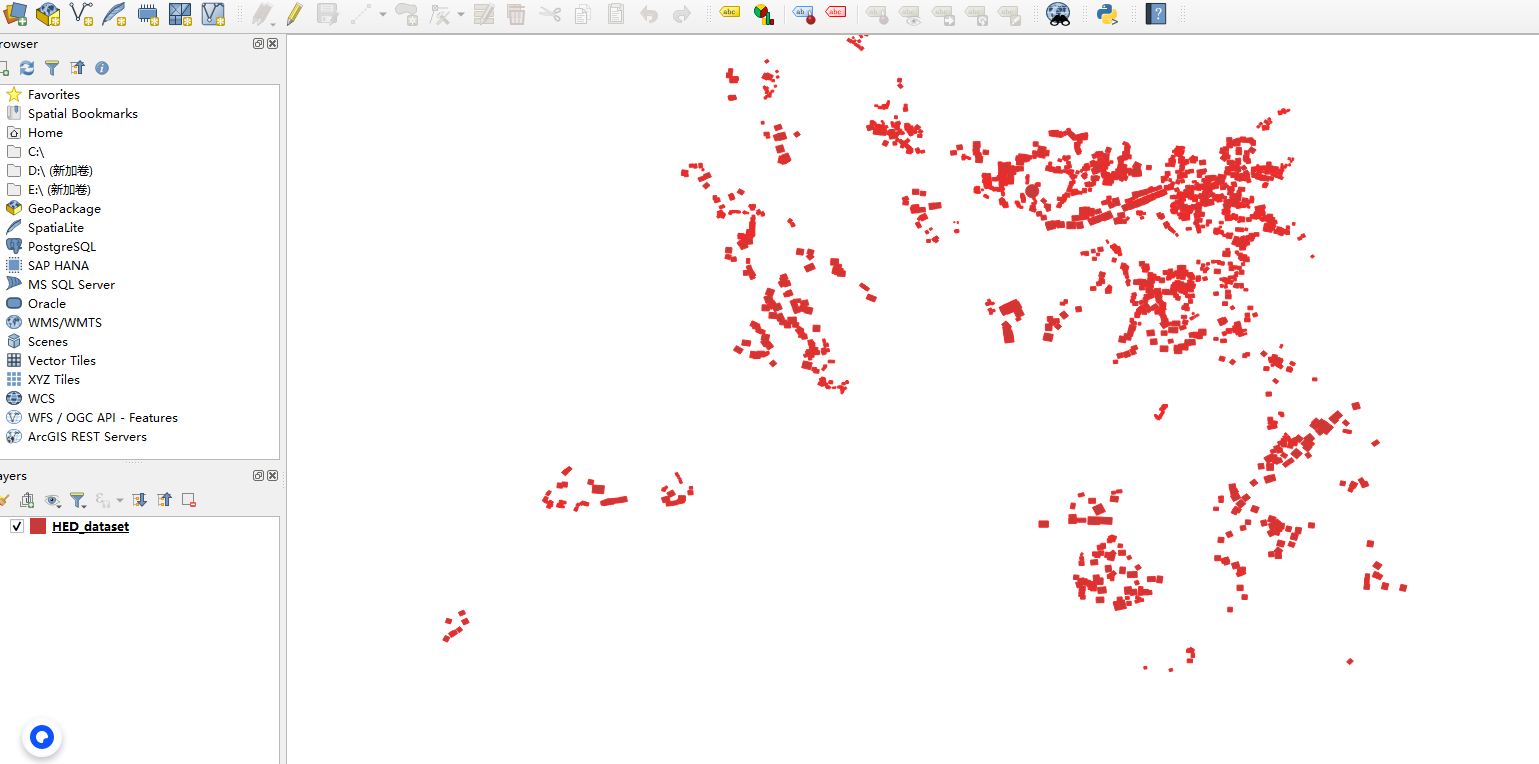
生成的文件可以作为缩略图,自己看情况改接口
总结
此方法供代码开发使用,使用geotools来生成缩略图
pom.xml自己看
        <!--GeoServer-->
        <dependency>
            <groupId>it.geosolutions</groupId>
            <artifactId>geoserver-manager</artifactId>
            <version>1.7.0</version>
        </dependency>
        <dependency>
            <groupId>org.geotools</groupId>
            <artifactId>gt-shapefile</artifactId>
            <version>23-SNAPSHOT</version>
        </dependency>

        <dependency>
            <groupId>org.geotools</groupId>
            <artifactId>gt-main</artifactId>
            <version>23-SNAPSHOT</version>
        </dependency>
        <dependency>
            <groupId>org.geotools</groupId>
            <artifactId>gt-referencing</artifactId>
            <version>23-SNAPSHOT</version>
        </dependency>
        <dependency>
            <groupId>org.geotools</groupId>
            <artifactId>gt-swing</artifactId>
            <version>23-SNAPSHOT</version>
        </dependency>
        <dependency>
            <groupId>org.geotools</groupId>
            <artifactId>gt-render</artifactId>
            <version>23-SNAPSHOT</version>
        </dependency>
        <dependency>
            <groupId>org.geotools</groupId>
            <artifactId>gt-xml</artifactId>
            <version>23-SNAPSHOT</version>
        </dependency>
        <dependency>
            <groupId>org.postgresql</groupId>
            <artifactId>postgresql</artifactId>
            <version>42.2.25</version>
        </dependency>
        <!-- https://mvnrepository.com/artifact/org.geotools.xsd/gt-xsd-sld -->
        <dependency>
            <groupId>org.geotools.xsd</groupId>
            <artifactId>gt-xsd-sld</artifactId>
            <version>23-SNAPSHOT</version>
        </dependency>
    </dependencies>


    <repositories>
        <repository>
            <id>osgeo</id>
            <name>OSGeo Release Repository</name>
            <url>https://repo.osgeo.org/repository/release/</url>
            <snapshots>
                <enabled>false</enabled>
            </snapshots>
            <releases>
                <enabled>true</enabled>
            </releases>
        </repository>
        <repository>
            <id>osgeo-snapshot</id>
            <name>OSGeo Snapshot Repository</name>
            <url>https://repo.osgeo.org/repository/snapshot/</url>
            <snapshots>
                <enabled>true</enabled>
            </snapshots>
            <releases>
                <enabled>false</enabled>
            </releases>
        </repository>
        <repository>
            <id>maven-central</id>
            <url>https://repo.maven.apache.org/maven2</url>
        </repository>
        <repository>
            <id>GeoSolutions</id>
            <url>http://maven.geo-solutions.it/</url>
        </repository>
    </repositories>


 1131
1131

 被折叠的 条评论
为什么被折叠?
被折叠的 条评论
为什么被折叠?
 到【灌水乐园】发言


