


// 定义研究区
var geometry = ee.FeatureCollection('projects/ee-13821256325a/assets/export');
Map.centerObject(geometry, 8);
// 加载 GEDI 脚点数据集
var gedi = ee.ImageCollection('LARSE/GEDI/GEDI02_A_002_MONTHLY');
// 质量筛选
var qualityMask = function(im) {
return im.updateMask(im.select('quality_flag').eq(1))
.updateMask(im.select('degrade_flag').eq(0));
};
// 筛选质量的GEDI数据
var filteredGedi = gedi.map(qualityMask);
// 合并所有影像
var mergedGedi = filteredGedi.mosaic();
// 裁剪到研究区
var clippedGedi = mergedGedi.clip(geometry);
// 提取GEDI脚点经纬度信息
var gediPoints = clippedGedi.select(['lat_highestreturn', 'lon_highestreturn']);
// 导出为TIF文件
Export.image.toDrive({
image: gediPoints,
description: 'GEDI_Points_Distribution',
scale: 100,
crs: 'EPSG:4326', // 使用经纬度坐标
fileFormat: 'TIF',
region: geometry
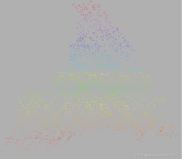
});导出到google drive中下载导入到arcmap中,效果图如下:


 223
223

 被折叠的 条评论
为什么被折叠?
被折叠的 条评论
为什么被折叠?
 到【灌水乐园】发言


