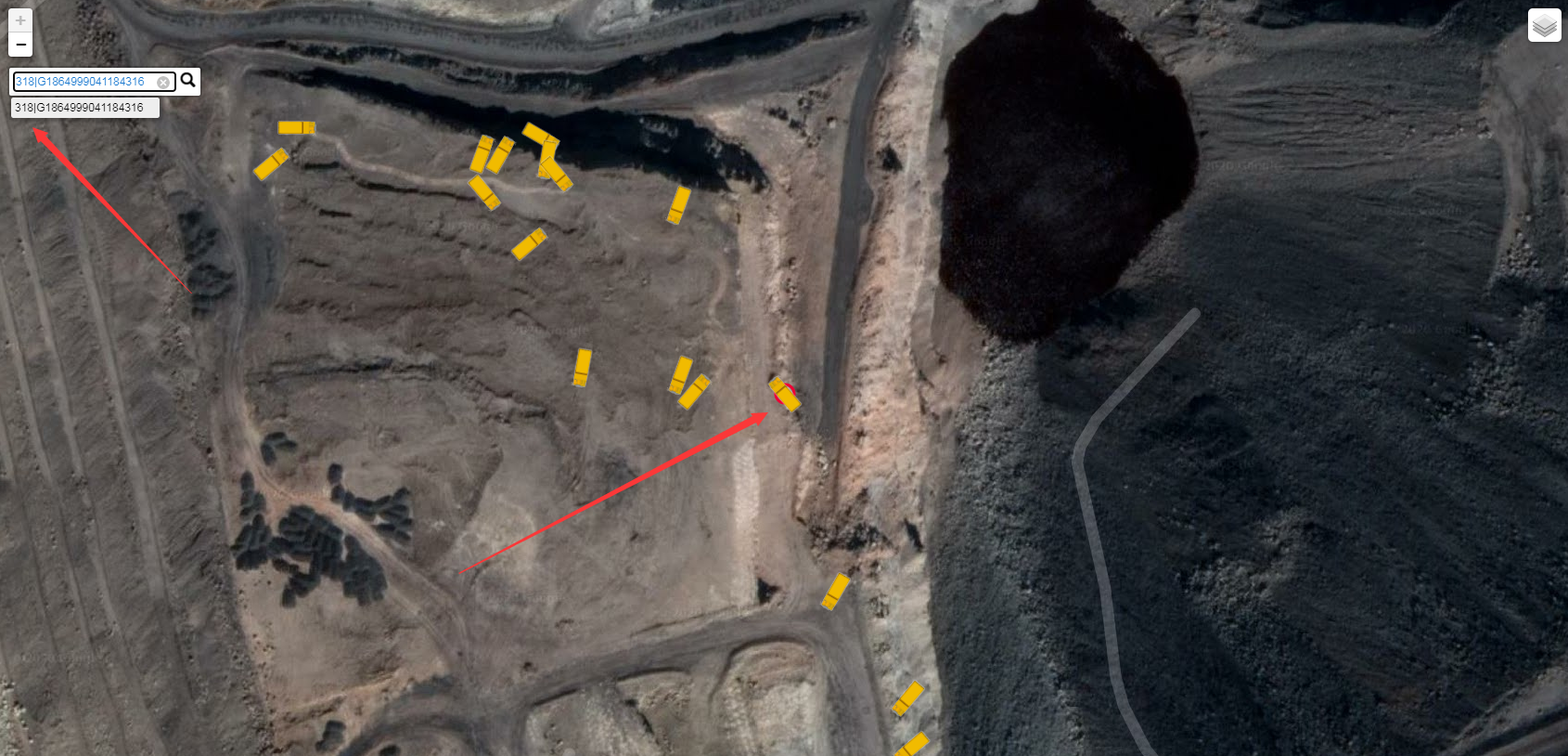
- 根据车辆实时经纬度信息,判断其方位角后选用对应的自定义图标标记(注:方位角度不同采用的图标不同);
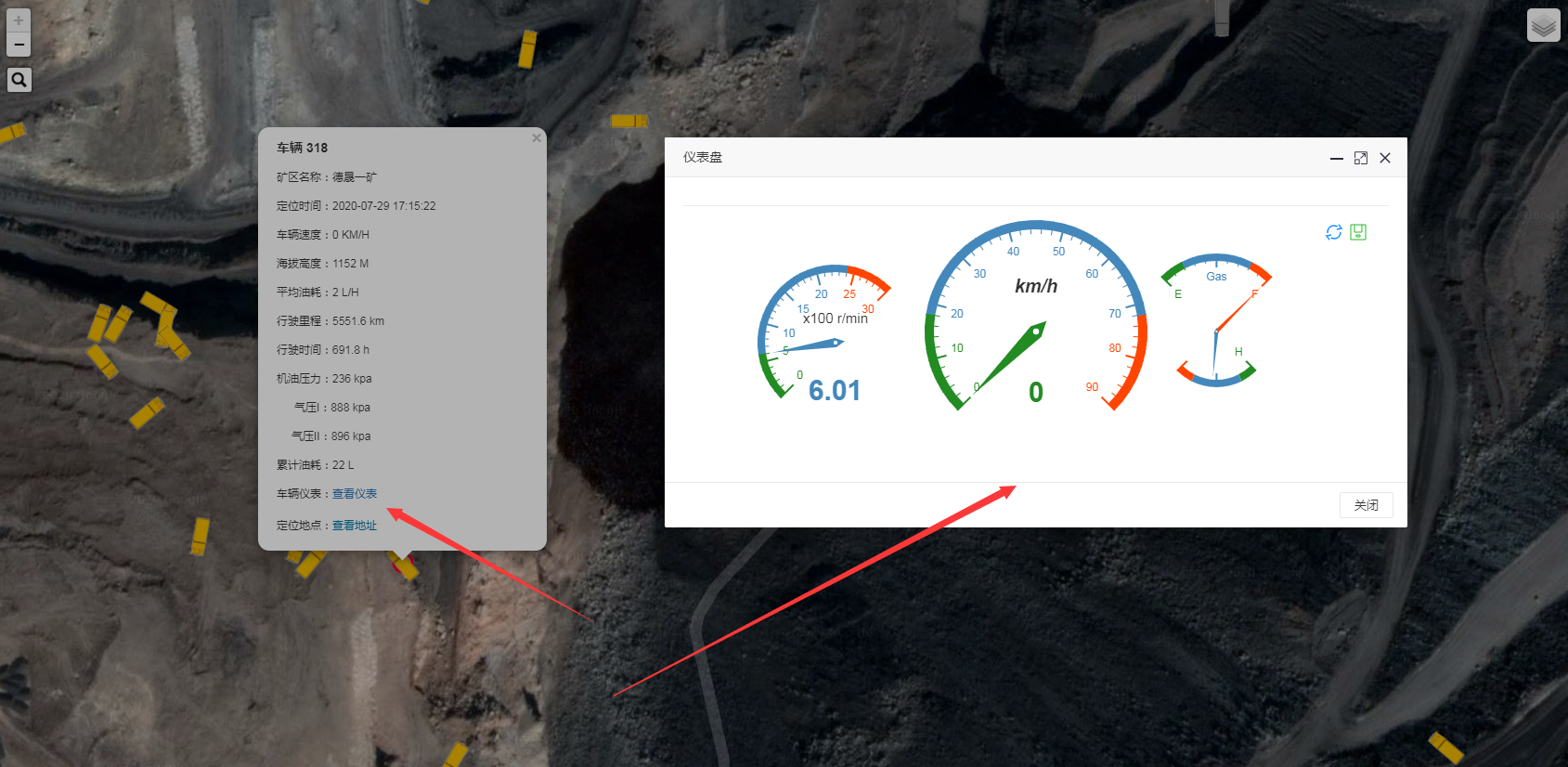
- 点击左上角搜索按钮可展开输入车辆自编号,并完成相关定位操作;点击车辆图标可查看车辆速度、海拔高度、平均油耗、行驶里程、行驶时间、机油压力、车辆仪表盘实时数据以及定位地点(调用阿里云逆地理编码接口,将经纬度转换为详细结构化的地址);
效果图:
// 经纬度 | 地图视区_存放一次性加载的车辆location数据 | GPS终端号
var longitudeAndLatitude, carLocationList, gpsTermina;
/** 聚类 */
var markers = L.markerClusterGroup({disableClusteringAtZoom: 17});
/** 谷歌地图 */
var normalMap = L.tileLayer.chinaProvider('Google.Normal.Map', {
maxZoom: 18,
minZoom: 5
}),
routeMap = L.tileLayer.chinaProvider('Google.Satellite.Annotion', {
maxZoom: 18,
minZoom: 3
});
/** 高德地图 */
var Gaode = L.tileLayer.chinaProvider('GaoDe.Normal.Map', {
maxZoom: 18,
minZoom: 5
}),
Gaodimgem = L.tileLayer.chinaProvider('GaoDe.Satellite.Map', {
maxZoom: 18,
minZoom: 5
}),
Gaodimga = L.tileLayer.chinaProvider('GaoDe.Satellite.Annotion', {
maxZoom: 18,
minZoom: 5
}),
Gaodimage = L.layerGroup([Gaodimgem, Gaodimga]);
/** 地图类型 */
var baseLayers = {
"谷歌地图": normalMap,
"谷歌影像": routeMap,
"高德地图": Gaode,
"高德影像": Gaodimage
}
/** 查询车辆位置集合 */
$.post(prefix + "/queryTheVehicle", function (results) {
if (JSON.parse(results.msg).length == 0) {
$.modal.msgError("Hi,受天气影响,暂无车辆位置信息!");
return false;
}
// 将location结果存放起来
var data = $.parseJSON(results.msg);
// 将location结果存放起来
carLocationList = $.parseJSON(results.msg);
// set center from first location
var map = new L.Map('map', {
zoom: 15,
center: [data[1].y, data[1].x],
layers: [routeMap],
});
L.control.layers(baseLayers).addTo(map);
map.addLayer(new L.TileLayer('http://{s}.tile.openstreetmap.org/{z}/{x}/{y}.png', {
maxZoom: 18,
attribution: '© <a href="http://www.sntonly.com/">OfficialWebsite</a> contributors, Points © 2020 Tonly'
})); // base layer
// layer contain searched elements | 层包含搜索服务
var markersLayer = new L.LayerGroup();
map.addLayer(markersLayer);
function customTip(text, val) {
return '<a href="#">' + text + '<em style="background:' + text + '; width:14px;height:14px;float:right"></em></a>';
}
map.addControl(new L.Control.Search({
layer: markersLayer,
buildTip: customTip,
autoType: true
}));
$.post(prefix + "/selectCanDataList", function (results) {
var locationMap = new Map();
for (var j in results) {
if (results[j].tboxVin != null && results[j].plate != null) {
locationMap.set(results[j].tboxVin, results[j].plate)
}
}
// populate map with markers from sample data | 使用来自示例数据的标记填充map
for (i in data) {
var title = locationMap.get(data[i].uid); // value searched | 搜索值
var loc = (data[i].y + "," + data[i].x).split(','); // position found | 位置发现
// 判断车辆状态(0在线 | 1离线)
if (data[i].status == 0) {
// 自定义(在线)图标标记
var onlineIcon = L.icon({
iconUrl: "../img/online/" + data[i].angle + ".png",
iconSize: [48, 48], // size of the icon | 图标的大小
shadowSize: [50, 64], // size of the shadow | 阴影的大小
// iconAnchor: [22, 94], // point of the icon which will correspond to marker's location | 对应于标记位置的图标点
shadowAnchor: [4, 62], // the same for the shadow | 影子也是一样
// popupAnchor: [-3, -76] // point from which the popup should open relative to the iconAnchor | 相对于图标描点,弹出窗口应该打开的点
});
var marker = new L.Marker(new L.latLng(loc), {icon: onlineIcon, title: title + "|" + data[i].uid});// se property searched
markers.addLayer(marker);
} else {
// 自定义(离线)图标标记
var offlineIcon = L.icon({
iconUrl: "../img/offline/" + data[i].angle + ".png",
iconSize: [48, 48], // size of the icon | 图标的大小
shadowSize: [50, 64], // size of the shadow | 阴影的大小
// iconAnchor: [22, 94], // point of the icon which will correspond to marker's location | 对应于标记位置的图标点
shadowAnchor: [4, 62], // the same for the shadow | 影子也是一样
// popupAnchor: [-3, -76] // point from which the popup should open relative to the iconAnchor | 相对于图标描点,弹出窗口应该打开的点
});
var marker = new L.Marker(new L.latLng(loc), {icon: offlineIcon, title: title + "|" + data[i].uid});// se property searched
markers.addLayer(marker);
}
// var marker = new L.Marker(new L.latLng(loc), {title: title + "|" + data[i].uid});// se property searched
marker.bindPopup(contentStrings);
markersLayer.addLayer(markers);
// bind event on marker | 标记上的绑定事件
marker.on('click', function (e) {
gpsTermina = e.sourceTarget.options.title;
gpsTermina = gpsTermina.substring(gpsTermina.indexOf("|") + 1, gpsTermina.length);
$.post(prefix + "/selectCanDataList", {
tboxVin: gpsTermina
}, function (results) {
// 从Redis结果中检索车辆所在位置海拔高度
var locationMaps = new Map();
for (var i in carLocationList) {
locationMaps.set(carLocationList[i].uid, carLocationList[i].altitude);
locationMaps.set(carLocationList[i].uid + "xy", carLocationList[i].x + "," + carLocationList[i].y);
}
if (locationMaps.get(gpsTermina)) {
// 海拔高度
var altitude = locationMaps.get(gpsTermina);
// 经纬度
longitudeAndLatitude = locationMaps.get(gpsTermina + "xy");
}
})
})
}
map.addLayer(markers);
})
});
// 查看地址
function getLocationDetails() {
$.post(prefix + "/getLocationDetails", {
longitudeAndLatitude: longitudeAndLatitude
}, function (results) {
$("#clickLocation").hide();
$("#detailedAddress").html(JSON.parse(results.msg).regeocode.formatted_address);
$("#detailedAddress").show();
});
};