


 本文介绍了一种使用Java和GeoTools库来处理JSON数据,结合河段信息绘制流量地理图片的方法。首先读取河段的JSON数据,接着将数据整合成新的GeoJSON格式,最后通过特定路径生成地图图片。
用geo-tools绘制河段流量生成图片
前言
1.需要绘制的河段json
2.接口查出的数据
一、流程
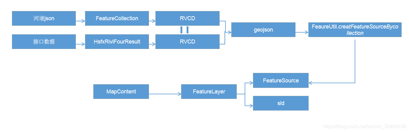
1.读河道的json
代码如下:
  public void DrawImage(HsfxRivlFourResult waterCondition, String endtime, String requestUrl, String pngFolder) throws IOException {

        //读json文件
        String filePath = "F:/2020/黑龙江省/jsons/HeiLongJiang/HLJRIVL.json";
        String jsondata = httpRequest(filePath, "GET");

        try {

            DataAssembly(jsondata, waterCondition.HsfxRivlFourResult, endtime, requestUrl, "0", pngFolder);

        } catch (Exception e) {

            e.printStackTrace();
        }
    }
2.将数据拼接成新的geojson
代码:
    public void DataAssembly(String jsondata, List<HsfxRivlFourVO> DataResult, String endtime, String requestUrl, String type, String pngFolder) throws IOException {


        JSONObject jobj = JSON.parseObject(jsondata);
        com.alibaba.fastjson.JSONArray movies = jobj.getJSONArray("features");//构建JSONArray数组

        List polyLines = new ArrayList<>();
        DateFormat sdf = new SimpleDateFormat("yyyy-MM-dd HH:mm:ss");

        for (int i = 0; i < movies.size(); i++) {

            JSONObject Jsonkey = (JSONObject) movies.get(i);
            JSONObject Jsonproperties = (JSONObject) Jsonkey.get("properties");
            String JsonRVCD = (String) Jsonproperties.get("RVCD"
最低0.47元/天 解锁文章


 1404
1404

 被折叠的 条评论
为什么被折叠?
被折叠的 条评论
为什么被折叠?
 到【灌水乐园】发言


