


 介绍了一种统一的三维城市模型,支持多维、多尺度及多层次细节表示;实现了多源三维地理空间数据的无缝集成,并参与制定了国家三维城市建模技术规范;开发了高效的三维地理空间数据库引擎,支持实时应用中的海量三维地理空间数据集成管理。
Developed by:
Wuhan University
China University of Geosciences ( wuhan )
Zhejiang University
Wuhan Land Resources and Planning Information Center
Supported By the National High Technology Research and Development Program (863 Program) of China (No. 2008AA121600).
Introduction
• A unified 3D city models , support multidimensional, multiscale and levels of detail representation of outdoor & indoor and aboveground & underground 3D objects
• Seamless integration of multisource 3D geospatial data, prepare the national standard 《 Technical specification for three dimensional city modeling 》
• High-efficient 3D geospatial database engine, supports integrated management of massive 3D geospatial data for real-time applications
• High-performance 3D geovisual analysis functions, supports multiuser 3D geo-collaboration based on the geospatial database
• A high-performance visualization engine exploiting the massively parallel computation architecture of modern GPUs, supports real-time realistic rendering of large-scale complicated 3D geospatial environments.
• Extendible and high-availability software architecture based on the hierarchical message bus, facilitates multimodal integrative applications of 2D GIS and 3D GIS
Technical specification for three dimensional city modeling
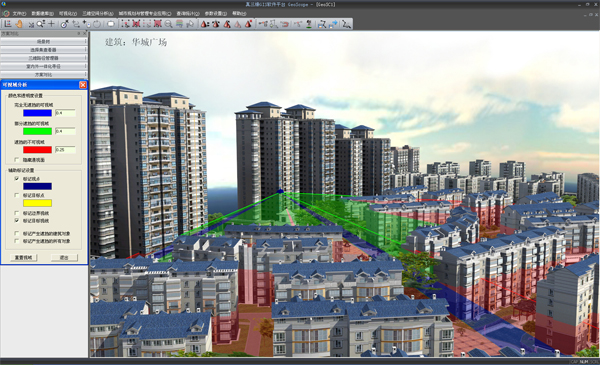
Viewshed analysis
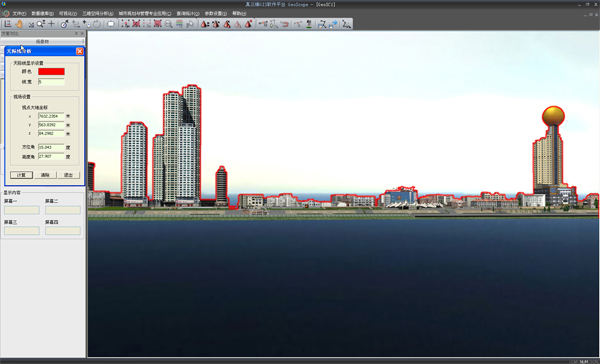
Skyline analysis
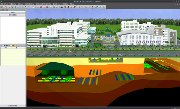
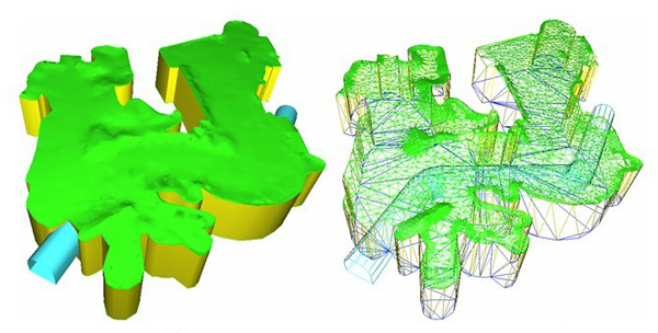
Uniform profile analysis for aboveground & underground 3D objects
Underground excavation analysis
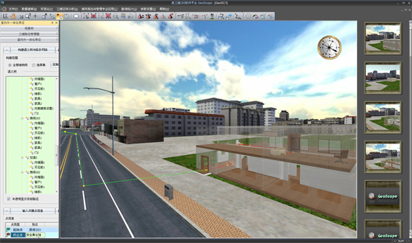
Indoor & outdoor routing for emergency response
更多信息请参考: http://vrlab.whu.edu.cn/


 595
595

 被折叠的 条评论
为什么被折叠?
被折叠的 条评论
为什么被折叠?
 到【灌水乐园】发言


