


 武汉大学城市研究实验室在国家地理国情普查与监测领域成为顶尖团队,提出了完整的地理国情普查与监测地图产品体系,并阐述了地理国情辅助决策综合分析专题地图的概念框架、设计理念和表达方式。工作中,研究了地理国情普查与监测地图产品的理论,设计了一系列专题地图。
1. Introduction
After a long time of accumulation and product development, Urban Research Laboratory of Wuhan University has becom the top team in the field of national geographic census and monitoring. Theoretically, it not only puts forward a complete product system of geographical condition survey and monitoring map, but also puts forward the conceptual framework, design concept and expression mode of thematic map of geographical condition aided decision comprehensive analysis. In practice, it has cooperated with relevant departments in a large number of first-tier cities such as Shanghai, Guangzhou, Shenzhen, Chongqing and Tianjin, and won unanimous praise. In the team, I systematically studied the product system of the census and monitoring map of geographical conditions and the thematic map drawing theory of the aided decision-making of geographical conditions, and independently produced a series of thematic maps.
2. Theoretical research
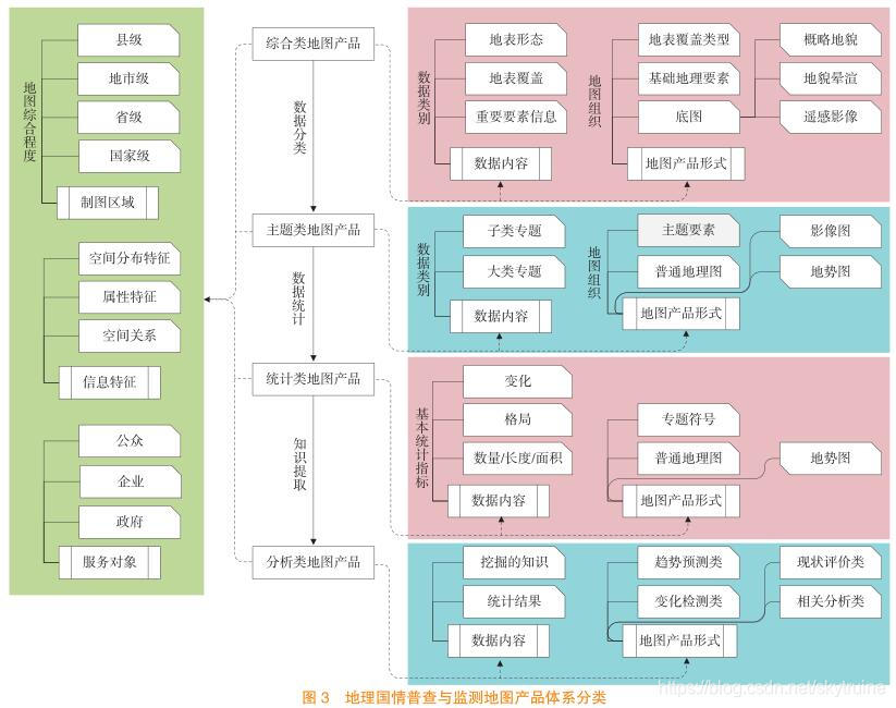
2.1 Research on Map Products System of Geographical Conditions Census and Monitoring
With the completion of the First Geographical Conditions Census, a large volume of national geographical data (NGD) have been collected and there is a pressing need for map products to represent the total conditions of these data. However, because of the lack of map products system, units of surveying and mapping have no sufficient guidance for production of NGD and result in providing little necessary services for governors, enterprises and public. In this paper, a whole set of map products system for NGD was presented based on map production. Using this system, a series of detailed guidance can be obtained by related units to improve current map production efficiency on NGD. Moreover, a logical framework of online NGD maps production system was proposed to improve the efficiency of thematic maps production. This system was put into application and had achieved good results.
2.2 Thematic map design
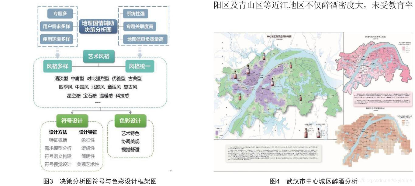
This paper puts forward the conceptual framework and design the concept of decision supporting the analysis map
based on geographiccensus, and elaborates its theme selection, representation and symbol and color design. Finally, Wuhan City Map is compiled as an example.
3. My Work
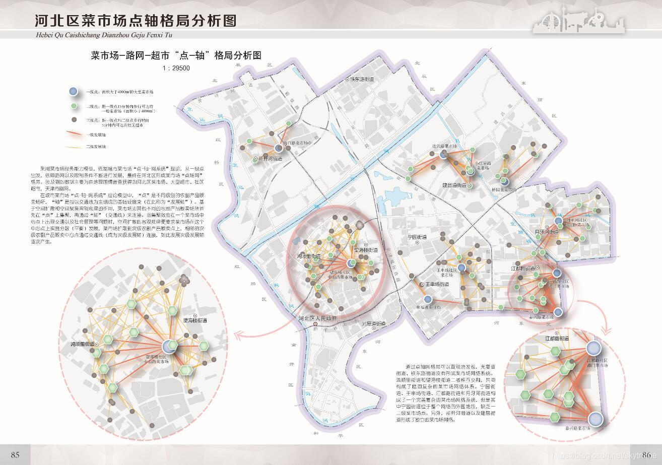
- Vegetable market network pattern analysis map of Heibei district in Tianjin
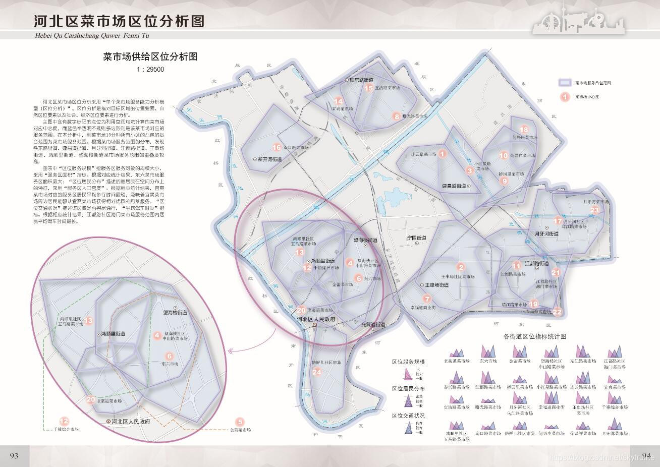
- Location analysis map of hebei vegetable market
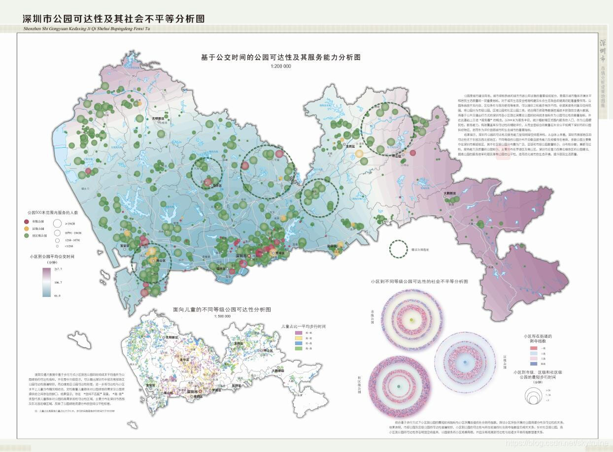
- Analysis map of park accessibility and social inequality in Shenzhen
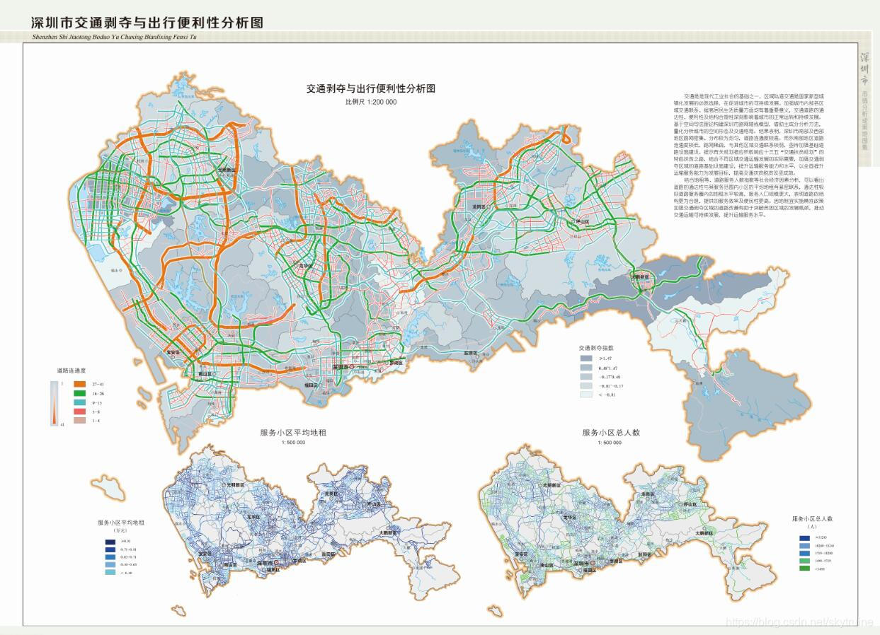
- Traffic deprivation and travel convenience analysis map of Shengzhen
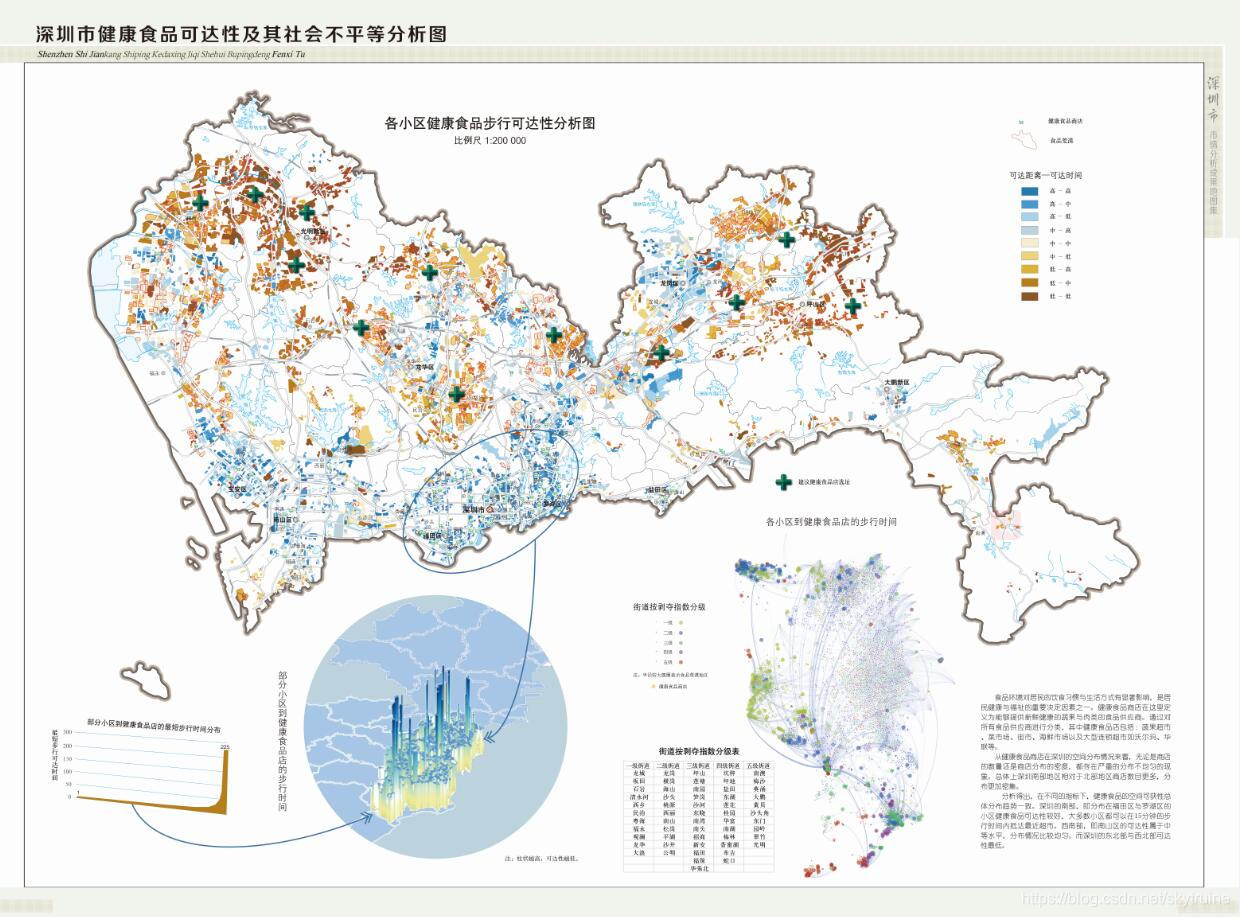
- Analysis map of health food accessibility and social inequality in Shenzhen
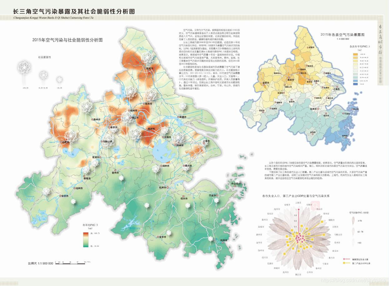
- Analysis map of air pollution exposure and its social vulnerability in Yangtze river delta
4. Publications
[1] Du, Q., Weng, M., Ren, F., Kang, M., Song, Y., 2016. Research on Map Products System of Geographical Conditions Census and Monitoring. Geospatial Information, 14: 1-7. (In Chinese)
[2] Weng, M., Luo, X., Li, W., Su, S., Luo, Y., 2017. Decision Supportting Thematic Maps Based on National Geographic Census: Conceptual Framework, Design Principle and Visualization Approach. Geomatics World, 24:11-14. (In Chinese)


 1万+
1万+

 被折叠的 条评论
为什么被折叠?
被折叠的 条评论
为什么被折叠?
 到【灌水乐园】发言


