


1 bus stop
https://datamall.lta.gov.sg/content/dam/datamall/datasets/Geospatial/BusStopLocation_Nov2024.zip
import pandas as pd
import geopandas as gpd
bs=gpd.read_file('BusStop.shp')
bs 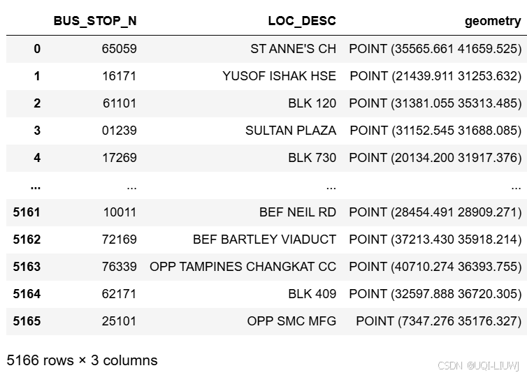
bs.geometry.plot() 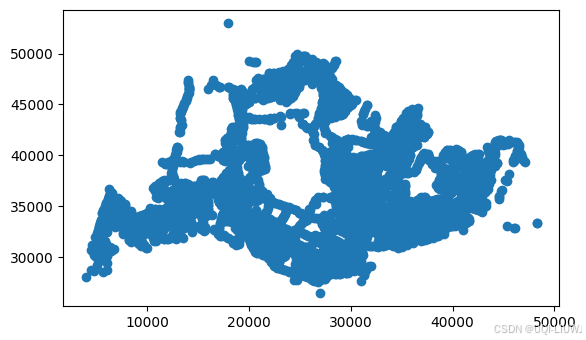
1.1 坐标系转换
LTA使用的是新加坡本地投影坐标系 S(ingapore )SVY21
-
它是一种投影坐标系,基于 Transverse Mercator 投影,中央经线为 103°50'00" E。
bs.crs
'''
<Projected CRS: PROJCS["SVY21",GEOGCS["WGS 84",DATUM["WGS_1984",SP ...>
Name: SVY21
Axis Info [cartesian]:
- [east]: Easting (metre)
- [north]: Northing (metre)
Area of Use:
- undefined
Coordinate Operation:
- name: unnamed
- method: Transverse Mercator
Datum: World Geodetic System 1984
- Ellipsoid: WGS 84
- Prime Meridian: Greenwich
'''
转换成经纬度,就直接用to_crs就行
bs_lonlat=bs.to_crs("EPSG:4326")
bs_lonlat 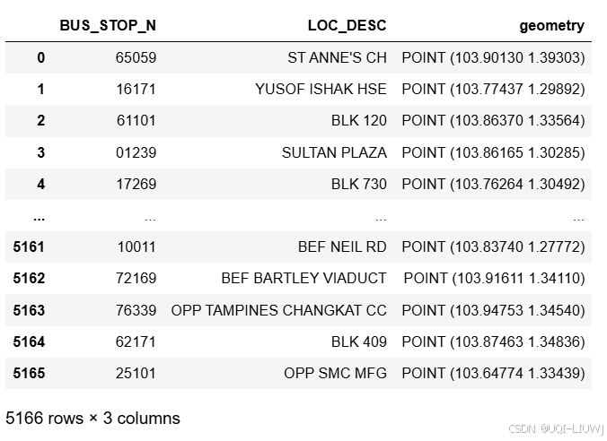
2 自行车道
https://datamall.lta.gov.sg/content/dam/datamall/datasets/Geospatial/CyclingPath_Nov2024.zip
cg=gpd.read_file('CyclingPathGazette.shp')
cg
最低0.47元/天 解锁文章


 被折叠的 条评论
为什么被折叠?
被折叠的 条评论
为什么被折叠?
 到【灌水乐园】发言


