


 本文介绍如何通过Python爬虫技术从阿里云数据平台获取中国各层级行政区划的GeoJSON数据,包括全国、省份、城市及区县地图,并提供详细的代码实现与文件组织结构。
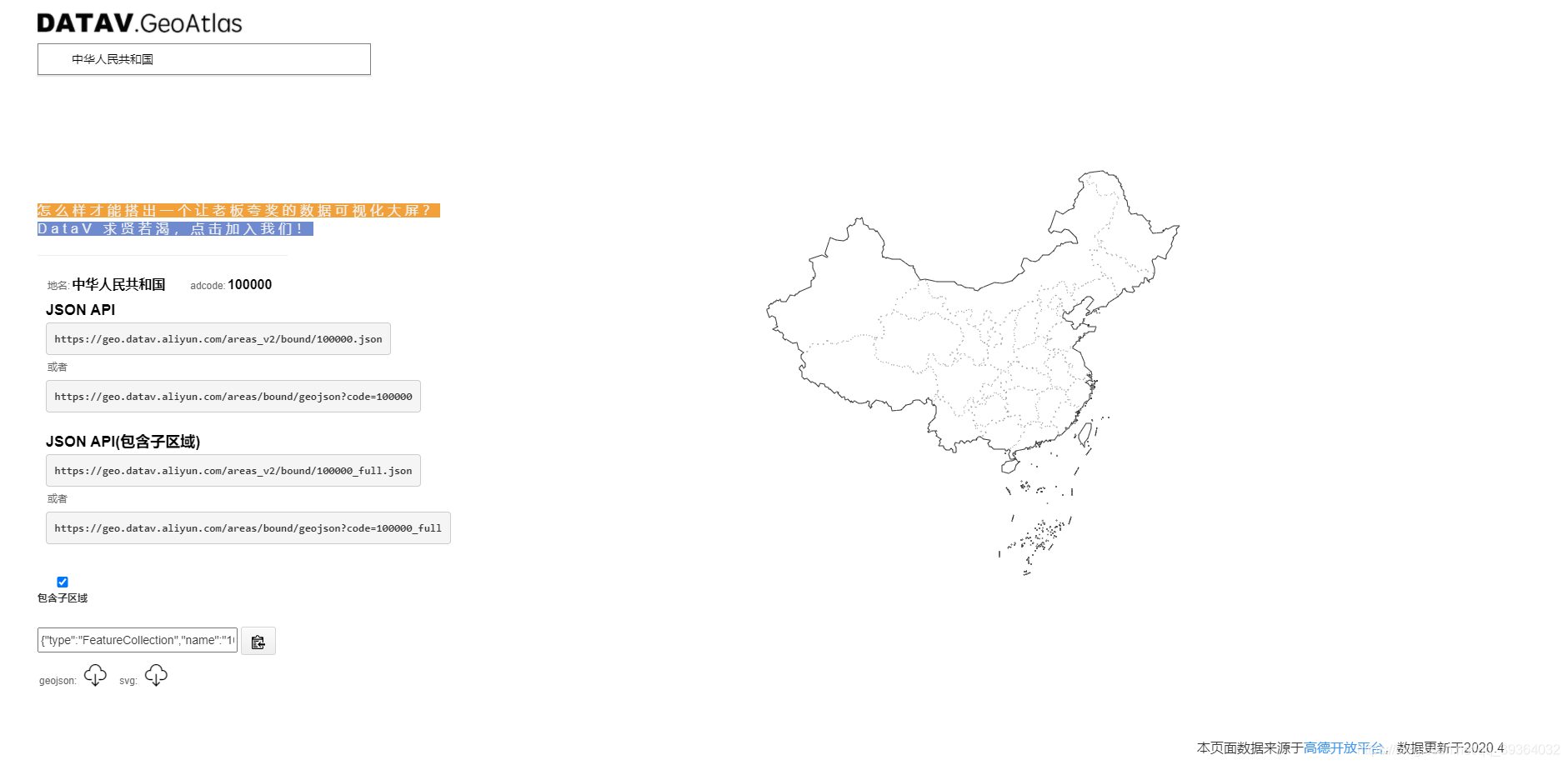
数据来源:http://datav.aliyun.com/tools/atlas/
目前提供两种格式数据下载:GeoJSON,svg
1.若仅需要一两个geojson,可直接从网站上下载即可;
2.若需要全量的,则可使用python爬取,主要代码如下
github地址: https://github.com/sky-Aimee/geoJson-cn
# -*- coding: UTF-8 -*-

import json
import urllib.request
import urllib.parse
import ssl
import os


# 将不包含子区域的geojson写入文件中
def write_json_to_file(item, text, level):
    if not os.path.isdir("data/" + level):
        os.mkdir("data/" + level)
    with open("data/" + level + "/" + item + ".json", "w", encoding='utf-8') as json_file:
        json.dump(text, json_file, ensure_ascii=False)


# 将包含子区域的geojson写入文件中
def write_full_json_to_file(item, text, level):
    if not os.path.isdir("data/" + level + "_full"):
        os.mkdir("data/" + level + "_full")
    with open("data/" + level + "_full/" + item + ".json", "w", encoding='utf-8') as json_file:
        json.dump(text, json_file, ensure_ascii=False)

# 若没有对应文件夹则创建对应文件夹
if not os.path.isdir("data"):
    os.mkdir("data")

if not os.path.isdir("data/country_full"):
    os.mkdir("data/country_full")
if not os.path.isdir("data/country"):
    os.mkdir("data/country")

if not os.path.isdir("data/province_full"):
    os.mkdir("data/province_full")
if not os.path.isdir("data/province"):
    os.mkdir("data/province")

if not os.path.isdir("data/city_full"):
    os.mkdir("data/city_full")
if not os.path.isdir("data/city"):
    os.mkdir("data/city")

if not os.path.isdir("data/district"):
    os.mkdir("data/district")

context = ssl._create_unverified_context()
url = "https://geo.datav.aliyun.com/areas_v2/bound/infos.json"
with urllib.request.urlopen(url, context=context) as response:
    html = json.loads(response.read().decode("UTF-8"))
    with open("location.json", "w", encoding='utf-8') as json_file:
        json.dump(html, json_file, ensure_ascii=False)

    for item in list(html.keys()):
        level = html[item]['level']
        # 将不包含子区域的geojson读取并写入文件中
        try:
            with urllib.request.urlopen(
                    "https://geo.datav.aliyun.com/areas_v2/bound/" + item + ".json",
                    context=context,
            ) as res:
                text = json.loads(res.read().decode("UTF-8"))
                write_json_to_file(item, text, level)
        except Exception as e:
            print(item, '报错', e)

        # 将包含子区域的geojson读取并写入文件中,中国geojson中街道没有子区域,故判断了level != "district"
        try:
            if level != "district":
                with urllib.request.urlopen(
                        "https://geo.datav.aliyun.com/areas_v2/bound/" + item + "_full.json",
                        context=context,
                ) as res:
                    text = json.loads(res.read().decode("UTF-8"))
                    write_full_json_to_file(item, text, level)
        except Exception as e:
            print(item, '报错', e)
    print("写入完成")
执行python之后得文件,对应文件夹解释:
- 全国地图-包含子区域: data/country_full
- 全国地图-外轮廓: data/country
- 全国各省地图-包含子区域:data/province_full
- 全国各省地图-外轮廓:data/province
- 全国各市地图-包含子区域:data/city_full
- 全国各市地图-外轮廓:data/city
- 全国各区县地图-外轮廓:data/county
- 全国省市区县所对应行政区划代码以及中心点的坐标:location.json (方便用于echarts上显示某个点的位置)可直接用于echarts地图的显示
若是业务当中不对省市区县层级做要求,可将数据分为 包含子区域,不包含子区域的两个文件夹
若此geojson不够全面,可参考国家地理信息公共服务平台: https://www.tianditu.gov.cn/


 961
961

 被折叠的 条评论
为什么被折叠?
被折叠的 条评论
为什么被折叠?
 到【灌水乐园】发言


