Nature上的Google Earth还是Google Earth上的Nature

GoogleEarth不仅让数字地球概念变为现实,还通过类似个人电脑普及计算机的方式推动了地理信息系统(GIS)的民主化。ESRI创始人Jack Dangermond认为GoogleEarth是GIS领域中最具震撼力的产品。面对GoogleEarth带来的挑战,ESRI发布了ArcGIS Explorer,被业界视为潜在的竞争者。

摘要生成于 C知道 ,由 DeepSeek-R1 满血版支持, 前往体验 >

Google Earth上了这一期的Nature封面,其中发表了 Declan ButlerVirtual globes: The web-wide world。

cover_nature.jpg

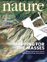
全文见: http://www.nature.com/nature/journal/v439/n7078/full/439776a.html

其中提到了Gore 在1998年提出的数字地球,并谈到“the project died a death in 2001 after Gore lost the 2000 US presidential election.” 那么看来国内的数字地球炒作实在是有点“拾人牙慧”的嫌疑。不过,是Google Earth第一次使数字地球或者“virtual globes”成为现实。

节录几句话:

"It's like the effect of the personal computer in the 1970s, where previously there was quite an élite population of computer users," Goodchild enthuses. "Just as the PC democratized computing, so systems like Google Earth will democratize GIS."

"Google Earth is just the most fantastic thing I have ever seen," says Jack Dangermond, founder and president of ESRI...

--这个大概可以说明Google Earth对GIS业界和学界的一点震撼。

As part of the package, ESRI will also release a free visualization tool, ArcGis Explorer, which some GIS professionals are calling a Google-Earth killer.

--所以,不管ESRI是否承认ArcGIS Explore是不是在Google Earth的压力下推出,是否要和其竞争,事实就是这样。国内的开发商是不是应该有所动作?

其他的还是大家自己看了 :) ,或许我们从中可以得到一些动力或者压力,有灵感更好! 


内容概要:本文针对国内加密货币市场预测研究较少的现状,采用BP神经网络构建了CCi30指数预测模型。研究选取2018年3月1日至2019年3月26日共391天的数据作为样本,通过“试凑法”确定最优隐结点数目,建立三层BP神经网络模型对CCi30指数收盘价进行预测。论文详细介绍了数据预处理、模型构建、训练及评估过程,包括数据归一化、特征工程、模型架构设计(如输入层、隐藏层、输出层)、模型编译与训练、模型评估(如RMSE、MAE计算)以及结果可视化。研究表明,该模型在短期内能较准确地预测指数变化趋势。此外,文章还讨论了隐层节点数的优化方法及其对预测性能的影响,并提出了若干改进建议,如引入更多技术指标、优化模型架构、尝试其他时序模型等。 适合人群:对加密货币市场预测感兴趣的研究人员、投资者及具备一定编程基础的数据分析师。 使用场景及目标:①为加密货币市场投资者提供一种新的预测工具和方法;②帮助研究人员理解BP神经网络在时间序列预测中的应用;③为后续研究提供改进方向,如数据增强、模型优化、特征工程等。 其他说明:尽管该模型在短期内表现出良好的预测性能,但仍存在一定局限性,如样本量较小、未考虑外部因素影响等。因此,在实际应用中需谨慎对待模型预测结果,并结合其他分析工具共同决策。
### Google Earth Engine MODIS 8-Day Terra and Aqua Cloud Cover Composite Product Documentation and Usage In the context of satellite data processing within platforms like Google Earth Engine (GEE), specific products cater to various environmental monitoring needs. For snow coverage, an enhanced MODIS 8-day Terra and Aqua integrated product exists specifically tailored for High Mountain Asia (HMA)[^1]. However, regarding cloud cover, while not directly addressed in the provided references about snow or vegetation indices[^3][^4], one can infer that similar methodologies apply due to the nature of how these datasets are processed. #### Understanding the Data Source The input data for such a composite would likely come from both MODIS Terra (MOD) and MODIS Aqua (MYD). These satellites have distinct overpass times which influence their ability to capture different conditions throughout the day. Specifically, Terra passes at approximately 10:30 AM/PM local time whereas Aqua does so around 1:30 PM/AM[^2]. For cloud cover analysis using GEE's MODIS suite: - **Data Collection**: Utilizes daily observations made by both sensors. - **Temporal Resolution**: An 8-day synthesis period aligns with other MODIS products designed for reducing noise through temporal aggregation. - **Spatial Resolution**: Likely maintains consistency with related MODIS products offering resolutions suitable for regional studies. #### Accessing and Using the Dataset To work with this type of dataset in GEE involves several key steps typically including loading the collection into your script environment, filtering based on date range or geographic area, applying any necessary corrections or transformations, and finally visualizing or exporting results. Here’s a basic example demonstrating how you might load and visualize an 8-day cloud mask layer derived potentially from either sensor but adapted here conceptually for illustration purposes only since exact implementation details depend heavily upon actual available layers matching described specifications: ```javascript // Load MODIS/Terra+Aqua Cloud Cover 8 Day Composite ImageCollection var modisCloudCover = ee.ImageCollection('MODIS/006/MOD09GA') // Placeholder path; adjust according to real dataset ID .filterDate('YYYY-MM-DD', 'YYYY-MM-DD'); // Specify start and end dates Map.setCenter(longitude, latitude); // Set map view center coordinates Map.addLayer(modisCloudCover.select(['state_1km']), {min: 0, max: 1}, 'Cloud Mask'); ``` This code snippet assumes existence of a compatible image collection named similarly to existing MODIS collections found within GEE catalogues. Adjustments will be required depending on precise naming conventions used for hypothetical cloud cover composites. --related questions-- 1. What preprocessing techniques improve accuracy when analyzing multi-temporal cloud masks? 2. How do varying spatial resolutions impact interpretation of cloud patterns across diverse landscapes? 3. Can machine learning algorithms enhance detection rates compared to traditional threshold-based methods? 4. Are there seasonal variations influencing effectiveness between morning versus afternoon satellite acquisitions?
评论
添加红包

请填写红包祝福语或标题

红包个数最小为10个

红包金额最低5元

当前余额3.43前往充值 >
需支付:10.00
成就一亿技术人!
领取后你会自动成为博主和红包主的粉丝 规则
hope_wisdom
发出的红包
实付
使用余额支付
点击重新获取
扫码支付
钱包余额 0

抵扣说明:

1.余额是钱包充值的虚拟货币,按照1:1的比例进行支付金额的抵扣。
2.余额无法直接购买下载,可以购买VIP、付费专栏及课程。

余额充值