


 本文介绍了如何使用高德地图API实现绘制多边形区域并支持编辑,包括marker定位判断内外、鼠标工具和PolyEditor的交互。通过React组件展示了具体步骤和关键代码实例。
前言:使用高德地图api实现绘制多边形区域,使用高德地图新出的特性实现编辑多边形区域。并且给定一个定位,判断是在区域内部还是外部。
参考链接:
高德地图api:鼠标工具-绘制覆盖物-工具类-示例中心-JS API 2.0 示例 | 高德地图API
react 组件:https://github.com/310731483/react-amap
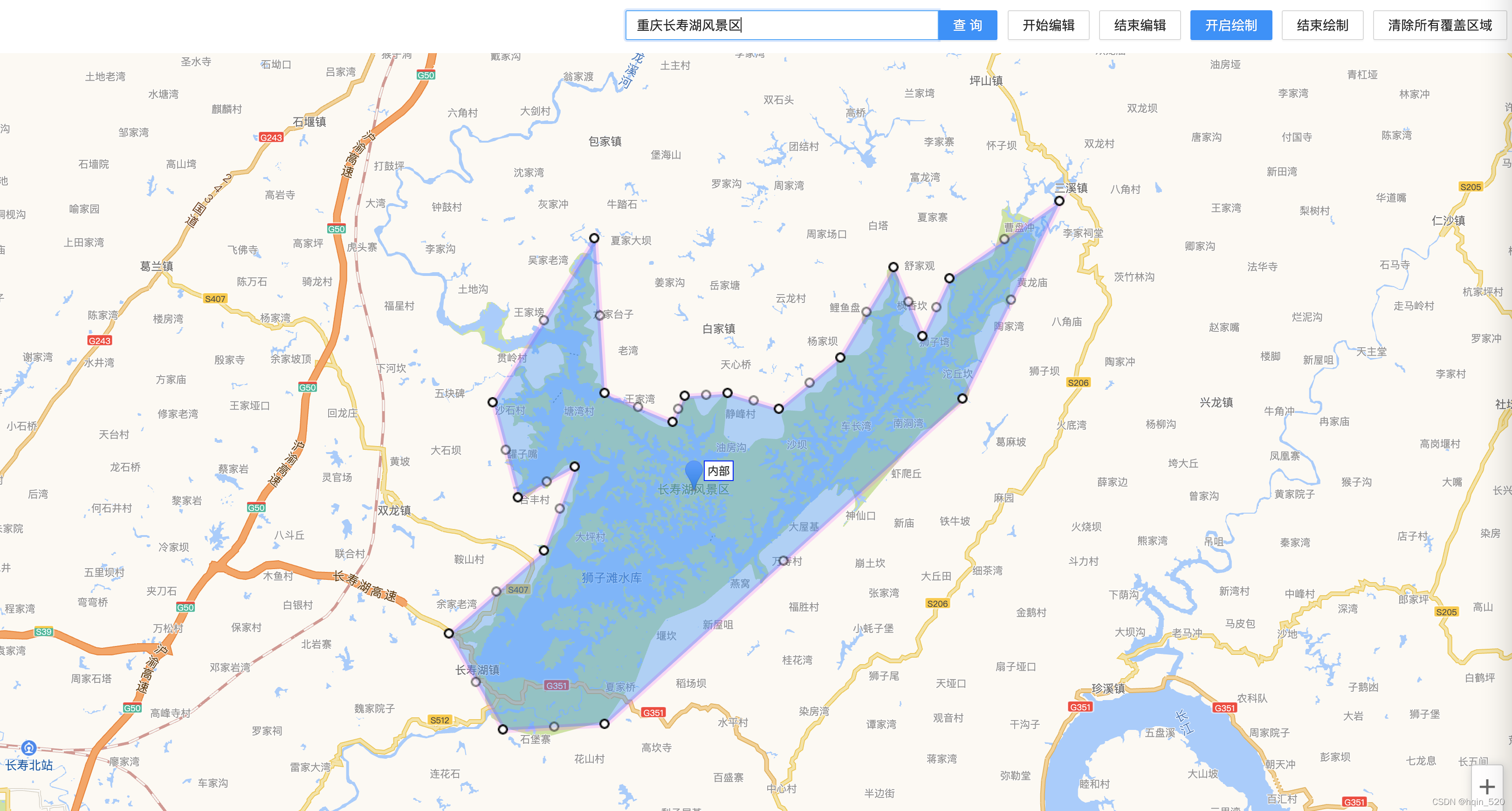
实现效果:
主要实现代码:
   <Input.Search
          placeholder="请输入地址"
          enterButton="查询"
          onSearch={value => search(value)}
          style={{ display: 'inline-block', width: 400, marginRight: 10 }}
        />
        <Button type="default" onClick={startEditPolygon} style={{ marginRight: 10 }}>
          开始编辑
        </Button>
        <Button type="default" onClick={closeEditPolygon} style={{ marginRight: 10 }}>
          结束编辑
        </Button>
        <Button
          type="primary"
          onClick={drawPolygon}
          style={{ marginRight: 10 }}
        >
          开启绘制
        </Button>
        <Button type="default" onClick={close} style={{ marginRight: 10 }}>
          结束绘制
        </Button>
        <Button type="default" onClick={clear} style={{ marginRight: 10 }}>
          清除所有覆盖区域
        </Button>


<div style={{ width: '100%', height: '100%' }}>
          <AMap
            zoom={10}
            plugins={['ToolBar']}
            amapkey={''}
            events={{
              created: (mapinst: any) => {
                setmap(mapinst);
              },
            }}
          >
            {markerPosition ? <Marker position={markerPosition} label={label} /> : ''}
            <MouseTool
              events={{
                created: (tool: any) => {
                  setselfTool(tool);
                },
                draw({ obj }: any) {
                  drawWhat(obj);
                },
              }}
            />
            <Polygon path={path} visible={path ? true : false} style={showStyle}>
              <PolyEditor
                active={polygonActive}
                events={{
                  created: () => { },
                  addnode: () => { },
                  adjust: () => { },
                  removenode: () => { },
                  end: (event: any) => {
                    setPath(event.target.getPath());
                  },
                }}
              />
            </Polygon>
          </AMap>
        </div>
实现方法:
 const showStyle = {
    strokeColor: '#FF33FF',
    strokeWeight: 6,
    strokeOpacity: 0.2,
    fillColor: '#1791fc',
    fillOpacity: 0.4,
    // 线样式还支持 ' dashed'
    strokeStyle: 'solid',
    // strokeStyle是dashed时有效
    // strokeDasharray: [30,10],
  };


  const drawPolygon = () => {
    if (selfTool) {
      selfTool.polygon(showStyle);
    }
  };
  const drawWhat = async obj => {
    let text = '';
    switch (obj.CLASS_NAME) {
      case 'AMap.Marker':
        text = `你绘制了一个标记,坐标位置是 {${obj.getPosition()}}`;
        break;
      case 'AMap.Polygon':
        text = `你绘制了一个多边形,有${obj.getPath().length}个端点`;
        break;
      case 'AMap.Circle':
        text = `你绘制了一个圆形,圆心位置为{${obj.getCenter()}}`;
        break;
      default:
        text = '';
    }
    await setTextInfo(text);
    await setPath(_.compact(_.concat(path, [obj.getPath()])));
    await map.setFitView([_.last(map.getAllOverlays('polygon'))]);
    if (selfTool) {
      selfTool.close(true);
    }
    startEditPolygon();
  };
  const close = () => {
    if (selfTool) {
      selfTool.close();
    }
    setTextInfo("关闭了鼠标工具");
    closeEditPolygon();
  };
  const submit = async () => {
    console.log(path, 'path');
  };
  // 开始编辑
  const startEditPolygon = () => {
    setpolygonActive(true);
  };
  // 结束编辑
  const closeEditPolygon = () => {
    setpolygonActive(false);
  };

  const clear = () => {
    setPath([]);
  };

  const search = (val: any) => {
    map.plugin('AMap.PlaceSearch', () => {
      const place = new window.AMap.PlaceSearch({
        pageSize: 10,
        pageIndex: 1,
      });
      // 进行搜索
      place.search(val, (status: any, result: any) => {
        const { info, poiList } = result;
        if (result.length) {
          return;
        }
        if (info !== 'OK') {
          return;
        }
        if (poiList.pois && Array.isArray(poiList.pois)) {
          let lnglat = _.head(poiList.pois).location;
          setMarkerPosition(lnglat);
          map.setFitView();
          //点是否在多边形内
          var isPointInRing = false;
          if (path && path.length) {
            path.forEach(element => {
              let isPointInRing2 = window.AMap.GeometryUtil.isPointInRing(lnglat, [element]);
              if (isPointInRing2) {
                isPointInRing = isPointInRing2;
                return;
              }
            });
          }
          setLabel({
            content: isPointInRing ? '内部' : '外部',
            offset: new window.AMap.Pixel(20, 0),
          });
        }
      });
    });
  };


 1162
1162

 被折叠的 条评论
为什么被折叠?
被折叠的 条评论
为什么被折叠?
 到【灌水乐园】发言


