


 本研究采用GIS技术对香港高密度城市进行本地气候区(LCZ)分类,通过分析建筑高度、表面比例、天际视域、地表覆盖类型等指标,揭示了城市形态对局部气候的影响。使用Kolmogorov-Smirnov测试评估不同地理区域对LCZ分类标准的统计影响。
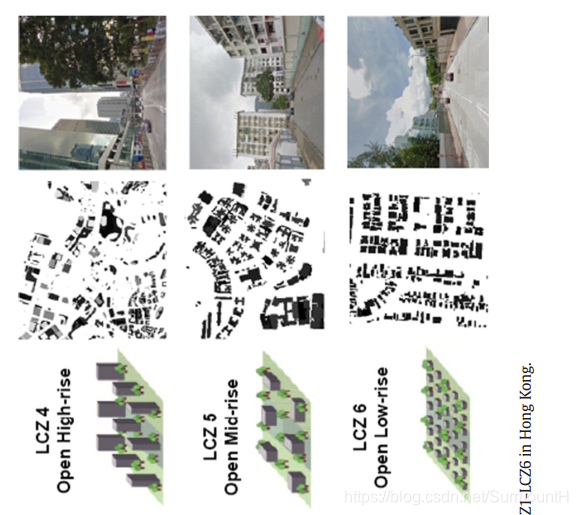
GIS-based mapping of Local Climate Zone in the high-density city of Hong Kong
urban morphology analysis maps
Method
Data
Building data:building footprint,building height
Street data
Topography data
Land use data 15 m-resolution
Remote sensing images
Analysis of spatial autocorrelation
Spatial autocorrelation reveals the geographical phenomenon that things closer display more similarity than those further away
确定grid大小
Kolmogorov–Smirnov test
Kolmogorov–Smirnov test (K-S test) is a nonparametric test to examine whether two datasets differentiate significantly.
to determine if different geolocations of the raster grid system influence the statistics of LCZ classification criteria
GIS-based LCZ classification and urban geometric analysis
Development of land surface analysis maps for LCZ classification
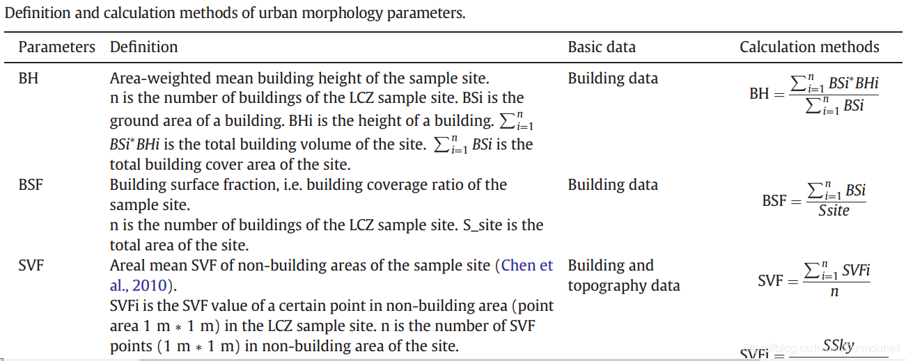
Building height (BH) map
Building height is mean building height of an LCZ grid, weighted with the footprint area of buildings.
Building surface fraction (BSF) map
compact or open
Sky view factor (SVF) map
Aspect ratio/height width ratio (H/W) map
Pervious surface fraction (PSF) map
Impervious surface fraction (ISF) map
Land use (LU) map
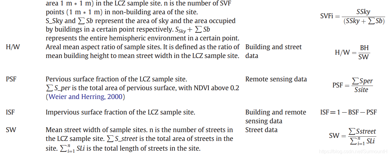
the BH map and BSF map were used to identify the building-type LCZ classes
seven land cover types have been classified according to the dominant land cover types


 被折叠的 条评论
为什么被折叠?
被折叠的 条评论
为什么被折叠?
 到【灌水乐园】发言


